Colorado Traffic Cameras - 1,155 Live CDOT Cams

CDOT publishes 1,167 active camera feeds across Colorado. 1,155 showed a live picture in the last 24 hours. See US DOT traffic camera statistics for every state's count.

Skip the map
Where the cameras are showing 802 of 1,167 cameras
US 6 MP 265.00 WB at W Tunnel 2 and E Tunnel 3I-70 MP 215.60 EB, 0.3 miles E of Eisenhower TunnelCO 91 MP 11.10 SB at Fremont Pass (North)CO-121 MP 18.00 NB at Ralston RdCO 93 MP 10.40 SB, 1.7 miles S of CO 128 in GoldenI-25 MP 217.95 SB, 0.5 miles S of 84th AveI-70 MP 186.10 EB, 3.5 miles W of Vail Pass SummitCO-128 MP 5.75 EB at Simms StCO 139 MP 34.85 NB at Douglas Pass (Roadway)I-70 MP 233.65 WB, 0.7 miles W of Mountain St in DumontUS 85 MP 248.20 SB at CR 26 in PlattevilleC-470 MP 5.65 WB at US-285CO-121 MP 2.80 NB at W Columbine DrI-70 MP 237.65 EB at Fall River RdC-470 MP 20.75 EB, 0.4 miles W of S University Blvd/CO 177I-25 MP 251.25 NB, 1.1 miles N of CO 56/WCR 44I-70 MP 25.50 EB at US 6/I-70BL in Grand JunctionCO 72 MP 0.30 WB at W 48th Ave/W I-70 Frontage Rd NI-70 MP 266.05 EB at EB I-70 Ramp to W 44th AveI-70 MP 238.90 EB at Stanley Rd/CR 312 in Idaho SpringsC-470 MP 20.35 WB, 0.7 miles W of S University Blvd/CO 177I-76 MP 74.50 EB, 1.3 miles E of Long Bridge Rd Port of EntryI-70 MP 299.35 EB at N Manila Rd in BennettCO-88 MP 17.00 WB at E Arapahoe Rd NB I-25 RampI-70 MP 132.30 EB, 1.3 miles W of Colorado River Rd in DotseroCO-177 MP 0.10 NB at E County Line RdI-25 MP 200.65 NB, 0.5 miles N of I-225CO 119 MP 2.15 SB, 2.1 miles N of US 6I-76 MP 3.20 WB at Federal Blvd/US 287I-25 MP 178.40 NB, 2.4 miles S of Plum Creek Pkwy on Frontage RdI-25 MP 101.35 SB at US 50/CO 47 in PuebloI-70 MP 128.10 WB, 0.5 miles W of Bair Ranch Rest AreaI-76 MP 68.60 WB, 2.5 miles E of CO 39/CO 52 on Frontage RdUS-287 MP 298.35 NB at W Midway BlvdUS 285 MP 119.10 SB at Poncha Pass (Road Surface)US 36 MP 38.15 EB, 0.6 miles E of Baseline RdCO 139 MP 34.85 NB at Douglas Pass (North)I-225 MP 0.10 SB (1), SB I-225 Ramp to SB I-25US 24 MP 322.55 WB at Judge Orr Rd in FalconI-225 MP 6.35 SB, 0.7 miles S of E Mississippi AveI-70 MP 165.95 WB, 0.9 miles W of Avon RdUS 36 MP 44.40 EB, 0.1 miles W of S 88th StUS 285 MP 119.10 SB at Poncha Pass (North)US 36 MP 37.50 EB at Baseline Rd WB Ramp to US 36 EBUS 85 MP 231.30 SB at E-470I-70 MP 256.60 WB, 0.6 miles E of Lookout MountainUS 287 MP 303.15 SB at W South Boulder RdUS-85 MP 228.60 SB at E 112th Ave Commerce CityCO 21 MP 134.55 SB at Bradley Rd in Colorado SpringsUS 50 MP 296.05 EB, 0.5 miles W of Old Portland Rd/CO 120CO-121 MP 14.85 NB at W 29th AveI-25 MP 250.90 NB, 0.7 miles N of CO 56/WCR 44 in Berthoud (1)I-25 MP 167.95 NB, 0.7 miles N of E Greenland RdI-225 MP 10.10 SB, 0.1 miles N of E Colfax AveI-25 MP 204.95 NB, 0.1 miles S of S University BlvdCO-88 MP 14.65 EB at S Quebec StCO-93 MP 0.85 SB at Washington AveUS 6 MP 259.05 EB at Center of Tunnel 6I-70 MP 257.00 EB, 1.0 mile E of Lookout Mountain (Camera 1)I-25 MP 59.10 SB, 0.4 miles N of Butte Rd/CR 103 on Frontage RdCO 7 MP 65.35 NB at Bonanza Dr/Lowell Blvd in BroomfieldI-25 MP 174.45 SB, 0.6 miles N of Sky View Ln on Frontage RdUS 6 MP 262.15 WB at Mayhem Gulch TrailheadUS-160 MP 85.30 EB at US-160A/Sawyer St, DurangoI-70 MP 208.90 WB, 3.3 miles E of US 6/CO 9 2 in SilverthorneCO 139 MP 39.85 NB at Douglas Pass (South)I-70 MP 188.60 WB, 1.5 miles W of Vail Pass SummitUS 36 MP 57.20 EB at I-25I-70 MP 171.75 WB, 0.7 miles E of Dowd JunctionUS 6 MP 270.35 WB, 0.2 miles E of Tunnel 1I-25 MP 7.65 SB at Exit Rd 8 in TrinidadI-70 MP 197.80 WB at Officers GulchI-25 MP 75.00 SB, 0.6 miles N of CO 165I-70 MP 175.30 EB, 1.0 mile W of Vail RdUS 6 MP 269.45 EB, 0.7 miles W of Tunnel 1CO-88 MP 14.20 EB at S Monaco StI-70 MP 276.55 WB at Colorado Blvd to WB I-70 RampI-70 MP 201.45 EB, 0.6 miles E of Main St in FriscoI-25 MP 127.85 SB at Sante Fe Ave in FountainI-25 MP 227.05 SB, 0.7 miles S of Northwest PkwyCO 9 MP 87.35 SB at N Main St Ave in BreckenridgeI-25 MP 237.10 SB, 2.6 miles N of CO 52I-70 MP 202.35 EB at CO 9 in FriscoI-70 MP 256.85 EB, 0.8 miles E of Lookout MountainUS 6 MP 265.15 EB at W Center of tunnel 2I-25 MP 213.95 NB, 0.2 miles N of I-70I-25 MP 175.50 SB, 1.0 mile N of Sky View LnI-70 MP 274.60 EB at Washington StI-70 MP 273.65 EB, 0.4 miles W of I-25US 50 MP 199.35 EB at Monarch Pass (East)US 36 MP 43.15 WB at McCaslin Blvd to WB US 36 RampUS 36 MP 46.15 WB, 0.4 miles E of NW Pkwy/Interlocken LoopUS 36 MP 50.05 EB, 0.4 miles W of W 104th AveI-25 MP 276.40 NB, 1.9 miles S of Cleveland Ave/CO 1I-76 MP 9.45 EB at Vasquez Blvd/US 6US 6 MP 273.95 EB at Heritage Rd in GoldenI-25 MP 200.10 SB, SB I-25 Ramp to NB I-225/DTC BlvdUS 6 MP 267.25 WB, 1.8 miles E of Tunnel 2US-50 MP 313.70 WB at Morris Ave/Fortino BlvdI-70 MP 116.85 EB, 0.4 miles E of Grand Ave in Glenwood SpringsI-25 MP 215.80 NB, 0.6 miles N of E 58th AveUS 285 MP 250.65 SB, 0.8 miles E of C-470CO-121 MP 23.35 SB at W 100th Ave/Church Ranch RdI-70 MP 245.40 WB, 1.2 miles E of US 6/US 40CO-88 MP 17.15 WB at S Boston St/S Clinton St TSGI-25 MP 39.50 SB, 1.0 mile S of Rugby Rd/CR 310.2 in LynnUS 50 MP 283.15 EB at Four Mile Pkwy in Canon CityI-25 MP 214.85 SB, 0.4 miles S of E 58th AveCO-121 002.30 SB at W Ken Caryl AveI-25 MP 241.15 NB, 1.3 miles N of CO 119CO-86 MP 101.00 WB at Woodlands Blvd Castle RockI-70 MP 231.75 EB, 0.1 miles W of US 40I-25 MP 182.65 NB, 0.8 miles N of Wolfensburger Rd/Wilcox StI-25 MP 118.75 SB, 0.1 miles S of Rancho Colorado BlvdI-25 MP 202.70 NB at E Yale AveI-25 MP 221.95 SB, 0.9 miles N of E 104th AveI-70 MP 282.20 WB, 0.4 miles W of I-225I-70 MP 204.65 EB, 0.7 miles W of US 6/CO 9 in SilverthorneUS 287 MP 300.85 NB at W Dillon Rd/NW Pkwy South RampI-70 MP 276.60 EB at Colorado Blvd to EB I-70 RampI-25 MP 207.40 SB, 0.2 miles S of Santa Fe DrI-70 MP 281.50 EB at Peoria StI-70 MP 210.65 EB, 2.9 miles W of Eisenhower TunnelI-25 MP 26.85 SB at CR 44 in LudlowI-25 MP 34.10 NB at I-25BL/CR 60 in LynnCO-121 MP 17.35 SB at W 53rd AveUS 34 MP 100.85 WB at WCR 17US 40 MP 257.50 WB at Empire JunctionI-70 MP 229.60 WB, 1.7 miles E of 15th St in GeorgetownUS-85 MP 227.35 NB at E 104th Ave Commerce CityUS 287 MP 301.80 NB at Empire Rd/CO 42I-76 MP 123.80 EB, 1.0 mile W of US 6 in SterlingI-70 MP 122.50 WB, 1.5 miles E of Grizzly CreekUS 50 MP 285.70 EB at Phantom Canyon Rd/CO 67 in PenroseI-70 MP 320.90 EB, 1.6 miles W of Peoria Rd/CR 201CO-121 MP 4.95 SB at W Crestline AveI-25 MP 169.70 SB, 2.8 miles N of E Greenland RdCO-121 MP 15.15 NB at W 32nd AveCO 9 MP 86.15 SB at Broken Lance Dr in BreckenridgeCO 115 MP 15.10 NB, 1.3 miles N of US 50 in PenroseI-70 MP 139.55 EB at Trail Gulch Rd in GypsumUS 36 MP 37.15 EB, 0.1 miles E of Colorado AveUS 6 MP 257.85 EB, 0.6 miles E of I-70US 6 MP 264.85 WB at Center of Tunnel 3CO 119 MP 1.65 SB, 1.7 miles N of US 6CO-93 MP 4.15 SB at W 64th PkwyCO-121 MP 3.35 NB at W Coal Mine AveI-225 MP 0.80 SB at DTC BlvdI-70 MP 238.50 WB, 0.5 miles W of Stanley Rd/CR 312I-25 MP 100.85 NB, 0.1 miles N of W 29th St in PuebloCO 9 MP 96.05 NB at Marina Rd in FriscoI-25 MP 269.40 SB at CO 14/E Mulberry StI-76 MP 6.95 EB, EB I-270 Ramp to EB I-76US 36 MP 55.85 EB, 0.1 miles W of N Pecos StCO 119 MP 2.75 SB, 2.8 miles N of US 6I-70 MP 258.75 EB at EB I-70 Ramp to CR 93 in GoldenUS-50 MP 279.80 WB at N Orchard AveI-25 MP 206.65 NB at S Logan StCO 139 MP 39.85 NB at Douglas Pass (Roadway)I-70 MP 238.05 EB, 0.3 miles E of Fall River RdI-225 MP 2.30 NB, 1.2 miles N of S Yosemite StI-70 MP 237.25 EB, 0.4 miles W of Fall River RdI-70 MP 281.55 WB at Peoria St UnderpassCO-121 MP 22.10 NB at W 92nd AveCO-88 MP 20.00 EB at S Potomac StCO-93 MP 1.25 SB at Golden Gate Canyon RdUS-287 MP 292.05 SB at W 98th Ave/Pine StI-76 MP 91.70 EB at US 6/US 34/I-76BUS in BrushI-25 MP 211.10 SB at W 23rd AveUS 6 MP 262.35 EB, 2.2 miles W of Tunnel 3I-70 MP 250.15 WB, 0.8 miles W of El Rancho in EvergreenI-25 MP 240.15 SB at CO 119CO-391 MP 8.60 SB at W 39th AveI-70 MP 277.05 WB at Dahlia StC-470 MP 8.75 WB, 0.9 miles E of W Bowles AveI-25 MP 106.15 SB, 1.8 miles S of Purcell Blvd in Pueblo WestI-70 MP 208.00 WB, 2.4 miles E of US 6/CO 9 in SilverthorneI-70 MP 233.30 WB, 0.9 miles W of Mountain St in DumontCO-177 MP 1.55 NB at E Easter AveI-76 MP 95.40 WB at CR 33 in HillroseI-76 MP 80.95 EB, 0.8 miles E of Main St/CO 52 in Fort MorganUS 36 MP 54.50 WB, 0.5 miles W of Federal BlvdI-70 MP 241.05 WB at Colorado Blvd E Exit in Idaho SpringsC-470 MP 6.95 WB, 0.8 miles E of Quincy AveUS 24 MP 320.85 WB at E Woodmen Rd in FalconI-70 MP 246.40 WB, 0.2 miles W of Homestead Rd in Beaver BrookI-225 MP 4.85 SB, 0.1 miles S of E Yale AveI-70 MP 177.90 EB at West Vail Chain StationI-76 MP 19.75 WB at E 136th AveI-70 MP 284.60 WB at N Airport BlvdCO-24 MP 308.50 EB, 0.3 miles N of CO 21 in Colorado SpringsI-76 MP 115.25 WB at CO 63 in AtwoodI-25 MP 179.70 NB, 1.2 miles S of Plum Creek PkwyCO-391 MP 9.45 SB at W 48th Ave/I-70 Frontage Rd SI-70 MP 242.45 WB at E Veterans Memorial TunnelsI-25 MP 273.50 SB, 2.1 miles N of ECR 50/Mountain Vista DrCO-72 MP 5.90 WB at W 80th AveCO 224 MP 0.30 EB at CO 53/BroadwayCO-72 MP 2.35 WB at W 64th AveCO-121 MP 1.20 NB at W Chatfield AveUS 24 MP 291.60 EB at Chipita Park RdI-225 MP 0.15 SB (2), SB I-225 Ramp to SB I-25US 287 MP 298.85 NB at W 10th AveI-70 MP 231.90 EB at US 40CO-177 MP 2.00 NB at E Arapahoe RdI-25 MP 223.05 NB at 120th Ave/CO 128US 6 MP 272.95 EB, 0.3 miles E of 19th St in GoldenI-70 MP 265.70 WB at Ward RdI-25 MP 216.95 SB at I-25 HOV N Lane Split (Camera 1)US 550 MP 87.95 NB, 2.2 miles N of Ironton Red Mountain Pass (Road Surface)I-70 MP 117.65 WB at W No Name TunnelC-470 MP 25.55 WB at S Yosemite StC-470 MP 13.95 EB at S Wadsworth Blvd/CO 121I-70 MP 168.95 WB at US 6 in EagleCO 74 MP 4.50 EB at Lewis Ridge Rd in EvergreenCO 72 MP 0.80 WB at W 52nd AveUS 6 MP 262.95 EB, 1.3 miles W of Tunnel 3CO-88 MP 13.65 EB at S Holly StI-70 MP 266.95 WB, 0.4 miles W of Kipling StI-25 MP 208.10 SB, 0.2 miles N of W Alameda AveUS 6 MP 268.40 EB, 2.1 miles W of Tunnel 1C-470 MP 15.00 WB, 0.5 miles W of S Platte Canyon Rd/CO 75US 50 MP 289.70 EB, 0.1 miles W of CO 115CO-88 MP 21.65 EB at S Parker Rd/CO-83 CentennialI-70 MP 206.85 EB, 1.4 miles E of US 6/CO 9 in SilverthorneCO 91 MP 11.10 SB at Fremont Pass (Road Surface)I-70 MP 223.35 WB, 2.1 miles E of Stevens Gulch Rd in BakervilleI-70 MP 419.85 EB, 0.5 miles E of Colorado Ave/Rd 30.5 in StrattonCO 72 MP 3.65 EB at Indiana StI-70 MP 288.55 EB, 0.4 miles W of E-470I-70 MP 222.40 WB, 1.2 miles E of Stevens Gulch Rd in BakervilleI-25 MP 188.50 NB at Castle Pines Pkwy to NB I-25 RampI-70 MP 306.40 EB, 0.8 miles E of CR 2/15th Ave in BennettC-470 MP 24.65 WB, 0.6 miles E of S Quebec StI-70 MP 267.40 EB at Kipling St to EB I-70 RampUS 6 MP 259.05 WB at Center of Tunnel 6I-25 MP 230.55 SB, 1.9 miles N of E Baseline Rd/CO 7I-70 MP 365.30 EB, 2.9 miles E of US 40/US 287 on Frontage Rd in LimonI-76 MP 77.60 EB, 1.8 miles E of US 34 in Fort MorganCO 224 MP 0.60 WB at I-25US 36 MP 53.15 WB, 0.7 miles E of Sheridan BlvdC-470 MP 21.65 WB, 0.6 miles E of S University Blvd/CO 177CO 9 MP 86.45 NB at S Main St in BreckenridgeUS 287 MP 302.30 SB at S Public Rd in LafayetteI-25 MP 252.30 NB at CO 60/CR 48 to NB I-25 Ramp in JohnstownI-70 MP 205.75 WB, 0.3 miles E of US 6/CO 9 in SilverthorneUS 36 MP 47.15 EB, 1.1 miles W of CO 121/Wadsworth PkwyI-25 MP 204.05 NB at Colorado Blvd/CO 2I-70 MP 243.25 WB, 0.3 miles E of Central City PkwyUS 85 MP 200.10 SB at Blakeland Dr TSGI-25 MP 213.65 NB, NB I-25 Ramp to WB I-70US 24 MP 297.55 EB at Cave of the Winds Rd in Manitou SpringsI-70 MP 175.85 WB, 0.3 miles W of Vail RdUS 50 MP 292.15 WB at K St in PenroseI-70 MP 225.80 WB, 0.1 miles E of Woodward St in Silver PlumeI-70 MP 191.75 WB, 1.6 miles E of Vail Pass SummitUS 40 MP 286.65 WB at Interplaza W in GoldenI-70 MP 217.40 WB, 1.0 mile W of Herman Gulch RdI-70 MP 128.80 EB, 0.2 miles E of Bair Ranch Rest AreaCO-177 MP 5.05 NB at E Quincy AveI-76 MP 80.10 EB at CO 52/Main St in Fort MorganI-225 MP 0.15 SB (1), SB I-225 Ramp to SB I-25US 50 MP 300.05 WB, 0.4 miles W of Stone City Rd in PuebloI-25 MP 13.00 NB at Van Buren St/CR 20.8 in TrinidadUS 85 MP 200.55 SB at W County Line Rd in LittletonUS-85 MP 230.30 SB at E 124th Ave BrightonCO 115 MP 40.35 SB at Pine Oaks Rd in Fort CarsonCO 9 MP 90.25 NB at Tiger Rd/Shores Ln in BreckenridgeUS-160 MP 231.50 EB at Craft Dr in AlamosaI-25 MP 170.45 NB at Larkspur Chain StationI-25 MP 197.65 NB, 0.6 miles N of E Arapahoe RdI-70 MP 203.20 EB, 0.9 miles E of CO 9 in FriscoCO 7 MP 63.20 NB at N 119th St in LafayetteI-25 MP 219.85 NB at Thornton PkwyI-70 MP 187.80 EB, 2.1 miles W of Vail Pass SummitUS 24 MP 283.75 WB at Trout Creek Rd/CR 25 in Woodland ParkI-76 MP 31.50 WB at Main St/CO 52 in HudsonI-25 MP 159.00 NB, 0.8 miles N of Baptist Rd in MonumentUS 85 MP 235.10 NB at W Bridge St/CO 7 in BrightonCO-83 MP 65.85 NB at S Lewiston Way CentennialCO-121 MP 16.75 NB at EB I-70 Ramp to Wadsworth BlvdI-25 MP 184.20 NB at Founders Pkwy/Meadows PkwyI-70 MP 371.50 EB at CR 31/CR 109 in GenoaI-70 MP 428.85 EB at CR 40 to EB I-70 Ramp in BethuneCO 9 MP 87.55 SB at Huron Rd in BreckenridgeCO-177 MP 3.15 NB at E Orchard RdI-76 MP 11.10 WB, 0.6 miles W of E 96th AveI-25 MP 100.10 SB at US 50 EB Ramp in PuebloI-70 MP 285.20 EB, 0.5 miles W of Tower RdI-25 MP 248.20 NB, 2.0 miles S of CO 56/WCR 44US 24 MP 292.40 EB, 0.8 miles E of Chipita Park Rd in CascadeUS 50 MP 305.90 EB at S McCulloch Blvd W in PuebloI-70 MP 275.25 EB at Brighton BlvdI-25 MP 247.60 NB, 3.2 miles N of WCR 34 on Frontage RdCO-74 MP 1.90 EB at N Bergen Pkwy N EvergreenUS-50 MP 281.15 WB at Steinmeier AveI-76 MP 75.70 EB at US 34 in Fort MorganC-470 MP 22.55 EB, 0.5 miles E of S Colorado BlvdI-70 MP 226.50 EB, 0.9 miles E of Woodward St in Silver PlumeCO 119 MP 3.35 SB, 3.4 miles N of US 6I-70 MP 271.35 WB, 0.2 miles W of Lowell BlvdI-270 MP 3.95 WB, 0.7 miles W of Quebec StI-25 MP 41.90 SB at Rouse Rd/CR 310US 40 MP 248.85 WB at Berthoud Falls (West)I-70 MP 263.50 EB, 1.2 miles E of Denver West Colorado Mills PkwyUS 6 MP 269.95 EB at Center of Tunnel 1I-70 MP 118.70 EB at No Name LaneUS 6 MP 268.70 EB, 1.7 miles W of Tunnel 1I-70 MP 297.35 EB, 2.7 miles E of Watkins RdCO-121 MP 20.65 NB at W 80th AveCO 119 MP 1.00 SB, 1.0 mile N of US 6I-76 MP 58.65 WB, 1.5 miles W of CR 36 in WigginsCO 93 MP 3.80 NB, 0.5 miles S of W 64th Pkwy in GoldenI-70 MP 275.55 EB at York StUS 6 MP 279.30 WB at Kipling St/CO 391 in LakewoodI-70 MP 268.95 WB at Wadsworth BlvdI-25 MP 23.00 NB at Hoehne Rd/CR 42I-70 MP 304.35WB at S 1st St BennettUS 24 MP 293.65 EB at Fountain Ave in CascadeI-25 MP 164.05 SB, 0.9 miles N of CO 404/County Line RdI-25 MP 160.80 NB, 0.1 miles N of CO 105 in MonumentI-70 MP 296.25 EB, 1.3 miles E of Watkins RdI-70 MP 116.60 EB at Grand Ave in Glenwood SpringsUS 24 MP 254.35 WB at Wilkerson Pass (West)I-70 MP 208.90 WB, 3.3 miles E of US 6/CO 9 3 in SilverthorneCO 9 MP 89.20 SB at Coyne Valley Rd in BreckenridgeCO-177 MP 1.00 SB at E Dry Creek RdI-25 MP 0.40 SB, 0.4 miles N of New Mexico BorderUS 6 MP 271.60 WB at CO 58/CO 93 in GoldenCO-93 MP 0.70 NB at Iowa DrI-25 MP 279.45 SB, 2.0 miles N of Cleveland Ave/CO 1I-70 MP 118.25 EB, 0.3 miles E of No Name TunnelC-470 MP 11.70 EB, 0.8 miles W of S Kipling PkwyI-70 MP 234.20 EB at Mountain St in DumontI-70 MP 178.45 EB at East Central Vail Chain StationI-25 MP 180.70 SB, 0.2 miles S of Plum Creek PkwyUS 85 MP 199.20 NB at Town Center DrI-25 MP 165.75 NB, 1.7 miles S of E Greenland RdI-70 MP 235.50 EB, 0.6 miles E of Stanley Rd in DumontI-25 MP 70.60 NB, 0.6 miles S of W Graneros Rd/CR CC319I-25 MP 226.10 SB at W 144th AveC-470 MP 7.90 EB at W Bowles Ave C-470 EB On-rampI-25 MP 249.20 NB, 1.0 mile S of CO 56 on Frontage RdC-470 MP 15.55 WB, 0.1 miles E of S Platte Canyon Rd/CO 75C-470 MP 18.55 EB, 0.1 miles E of Lucent BlvdI-25 MP 245.20 NB at WCR 34 MeadI-25 MP 250.30 NB at CO 56/WCR 44 in Berthoud (1)I-70 MP 137.05 EB, 3.0 miles W of Trail Gulch Rd in GypsumC-470 MP 18.40 WB at Lucent BlvdI-70 MP 264.15 EB, 0.2 miles W of W 32nd AveC-470 MP 17.75 EB, 0.7 miles E of S Santa Fe Dr/US 85CO 91 MP 22.20 NB at Copper Rd in Copper MountainI-70 MP 190.10 EB at Vail Pass SummitUS 36 MP 41.90 EB, 1.7 W of McCaslin BlvdI-70 MP 32.35 EB, 1.1 miles E of Horizon Dr in Grand JunctionI-25 MP 156.85 NB, 1.2 miles N of North Gate BlvdI-76 MP 16.50 EB at Sable Blvd/CO 2US 6 MP 260.70 EB, 0.5 miles E of CO 119US 6 MP 269.95 WB at Center of Tunnel 1I-70 MP 108.95 WB at Canyon Creek Rd in Glenwood SpringsI-225 MP 7.80 NB, 0.1 miles S of E Alameda AveI-70 MP 133.35 WB at Colorado River RdUS 34 MP 96.40 WB at WB US 34 to NB I-25 Ramp in LovelandUS 36 MP 40.45 EB at S Cherryvale RdCO-121 MP 3.60 NB at W Peakview DrCO 3 MP 1.60 NB at CO 3/Saw Mill St, DurangoI-225 MP 4.25 SB, 0.3 miles N of S Parker Rd/CO 83I-70 MP 200.75 EB, 0.2 miles W of Main St in FriscoI-70 MP 269.35 WB at WB I-76 to WB I-70 RampI-70 MP 267.40 WB at EB I-70 Ramp to Kipling StC-470 MP 4.15 EB, 0.1 miles W of CO-8/W Morrison RdC-470 MP 17.05 EB at S Santa Fe Dr/US 85I-70 MP 186.35 EB, 3.3 miles W of Vail Pass SummitI-70 MP 186.80 WB, 3.1 miles W of Vail Pass SummitI-70 MP 187.25 WB, 2.6 miles W of Vail Pass SummitI-70 MP 189.15 WB, 1.0 mile W of Vail Pass SummitUS 50 MP 199.35 EB at Monarch Pass (West)I-70 MP 189.45 WB, 0.7 miles W of Vail Pass SummitI-70 MP 190.45 WB, 0.4 miles E of Vail Pass SummitI-70 MP 192.10 WB, 1.8 miles E Vail Pass SummitCO 139 MP 39.85 NB at Douglas Pass (North)I-70 MP 213.45 EB, 0.1 miles W of Eisenhower TunnelCO 139 MP 34.85 NB at Douglas Pass (South)I-70 MP 215.90 WB, 0.7 miles E of Eisenhower TunnelUS 40 MP 248.85 WB at Berthoud Falls (East)CO 91 MP 11.10 SB at Fremont Pass (South)US 285 MP 119.10 SB at Poncha Pass (South)CO-14 MP 63.00 EB, 1.2 mi W of Cameron Pass (West)US 6 MP 226.25 WB, 2.5 miles W of Loveland Ski Area 2US 24 MP 254.35 WB at Wilkerson Pass (Road Surface)US 24 MP 254.35 WB at Wilkerson Pass (East)CO-14 MP 63.00 EB, 1.2 mi W of Cameron Pass (East)I-70 MP 120.85 WB, 0.2 miles W of Grizzly Creek Rest AreaUS 40 MP 248.85 WB at Berthoud Falls (South)I-70 MP 123.15 EB, 2.2 miles E of Grizzly CreekI-70 MP 241.65 EB, 0.6 miles W of Veterans Memorial TunnelsUS 6 MP 258.70 WB, 0.4 miles W of Tunnel 6US 6 MP 270.00 WB at E Tunnel 1US 6 MP 259.00 EB at W Tunnel 6US 550 MP 87.95 NB, 2.2 miles N of Ironton Red Mountain Pass (North)US 6 MP 269.75 EB, 0.2 miles W of Tunnel 1US 6 MP 266.10 WB, 0.7 miles E of Tunnel 2US 6 MP 265.10 EB at W Tunnel 2I-70 MP 242.00 EB, 0.2 miles W of Veterans Memorial TunnelsUS 6 MP 264.90 WB at E Tunnel 3US 6 MP 261.50 EB, 1.3 miles E of CO 119US 6 MP 265.55 EB, 0.2 miles E of Tunnel 2US 6 MP 266.70 EB, 1.3 miles E of Tunnel 2US 550 MP 87.95 NB, 2.2 miles N of Ironton Red Mountain Pass (South)US 6 MP 259.70 WB, 0.2 miles E of Tunnel 5US 6 MP 269.10 EB, 1.3 miles W of Tunnel 1US 6 MP 264.05 EB, 0.7 miles W of Tunnel 3US 6 MP 260.30 WB at CO 119US 6 MP 259.15 WB at E Tunnel 6US 6 MP 267.75 WB, 2.3 miles E of Tunnel 2US 6 MP 262.65 EB, 1.8 miles W of Tunnel 3US 6 MP 265.25 WB at E Center of Tunnel 2US 6 MP 265.35 WB at E Tunnel 2US 6 MP 264.80 EB at Center of Tunnel 3I-70 MP 86.10 EB, 0.8 miles W of US 6 in RifleI-70 MP 43.75 EB at US 6 in PalisadeI-70 MP 54.40 WB, 3.8 miles E of Beavertail TunnelI-70 MP 62.80 WB, 1.5 miles E of Roan Creek Rd in De BequeUS 160 MP 186.10 WB at CO 149 in South ForkUS-160 MP 35.20 WB at US-160A/CR G, CortezI-25 MP 17.70 SB at El Moro Rd/CR 32.4 in TrinidadI-25 MP 30.45 SB at CR 63.1 in AguilarI-25 MP 11.05 NB at Santa Fe Trail/CR 69.1/CR 69.3 in TrinidadUS-160 MP 37.40 WB at US-160A/7th St, CortezI-70 MP 195.25 EB at CO 91 in Copper MountainI-70 MP 208.90 WB, 3.3 miles E of US 6/CO 9 4 in SilverthorneI-70 MP 208.90 WB, 3.3 miles E of US 6/CO 9 1 in SilverthorneUS-160 MP 39.90 WB at US-160A/Hawkins St, CortezI-70 MP 145.80 EB, 1.0 mile W of Eby Creek RdI-70 MP 154.20 EB, 2.8 miles W of CO 131I-70 MP 193.10 WB, 2.0 miles W of CO 91 Copper MountainUS 85 MP 241.60 NB at 1st St/CO 52 in Fort LuptonI-25 MP 125.20 SB, 0.6 miles N of Ray Nixon RdI-70 MP 204.95 EB, 0.4 miles W of US 6/CO 9 in SilverthorneUS 36 MP 39.20 EB at CO 157/Foothills PkwyI-70 MP 208.90 WB, 3.3 miles E of US 6/CO 9 in SilverthorneUS-285 MP 257.65 NB at S University Blvd/CO-177I-70 MP 207.05 WB, 1.6 miles E of US 6/CO 9 in SilverthorneI-25 MP 150.65 NB, 0.4 miles N of N Academy BlvdUS 6 MP 208.70 WB at I-70 in SilverthorneUS 285 MP 243.15 SB, 0.9 miles S of N Turkey Creek RdI-70 MP 383.50 EB at CR 43 to EB I-70 Ramp in ArribaI-70 MP 96.40 EB, 1.2 miles W of 9th St in SiltI-25 MP 138.55 NB, 0.3 miles S of US 24 in Colorado SpringsI-70 MP 195.85 WB, 0.6 miles E of CO 91 Copper MountainI-225 MP 6.95 NB at E Mississippi AveUS 34 MP 97.65 EB, 0.2 miles W of N CR 3I-25 MP 48.55 NB, 0.6 miles S of I-25BL in WalsenburgI-70 MP 182.80 EB, 2.6 miles E of Big Horn Rd in VailUS 285 MP 244.65 NB, 0.6 miles N of N Turkey Creek RdI-70 MP 219.70 WB, 1.3 miles E of Herman Gulch RdCO 9 MP 95.45 SB at Peak One Blvd in BreckenridgeI-70 MP 244.35 EB at US 6/US 40I-70 MP 171.10 EB at Dowd JunctionUS 24 MP 313.20 EB at Marksheffel Rd in Colorado Springs TSGUS 24 MP 297.85 WB at Canon Ave in Manitou SpringsI-70 MP 179.90 WB at Big Horn Rd in VailCO 114 MP 61.50 WB, 0.2 mi W of 8th St/US 285 SaguacheI-70 MP 279.60 EB at Central Park BlvdI-25 MP 181.85 NB at E Wolfensberger Rd/Wilcox StI-25 MP 66.55 SB, 0.2 miles S of CR 670I-70 MP 116.20 EB, 0.4 miles W of CO 82 in Glenwood SpringsI-25 MP 130.20 NB, 2.0 miles S of CO 16/Mesa Ridge Pkwy in FountainI-25 MP 198.20 NB at E Orchard RdI-25 MP 177.05 SB, 3.8 miles S of Plum Creek PkwyCO 21 MP 136.60 SB at Grinnell Blvd in Colorado SpringsCO 94 MP 8.10 EB at N Curtis Rd in Colorado SpringsI-25 MP 33.30 NB, 0.8 miles S of I-25BL/CR 60 in LynnI-25 MP 235.15 SB at CO 52I-70 MP 198.40 EB, 0.5 miles E of Officers GulchUS-285 MP 257.70 SB at S Knox Ct/S Lowell BlvdI-25 MP 49.00 NB at I-25BL/Industrial Park Dr in WalsenburgI-70 MP 169.55 EB, 0.9 miles E of US 6 in EagleI-70 MP 209.85 WB, 3.8 miles W of Eisenhower TunnelI-25 MP 154.25 NB, 1.2 miles N of Interquest PkwyUS 285 MP 245.15 NB at Twin ForksI-70 MP 211.80 WB, 1.7 miles W of Eisenhower TunnelUS 24 MP 314.55 WB at Constitution Ave in Colorado SpringsUS 160 MP 232.75 WB at West Ave in AlamosaI-70 MP 185.00 WB, 4.8 miles W of Vail Pass SummitI-70 MP 340.35 EB at CR 166 Ramp to EB I-70 in AgateI-70 MP 280.60 WB at Havana St UnderpassI-25 MP 146.20 NB at Garden of the Gods RdUS 24 MP 289.70 EB, 0.2 miles E of Green Mountain Falls RdI-70 MP 309.30 WB, 0.9 miles W of Wagner St in StrasburgI-70 MP 276.05 WB at Steele St to WB I-70 RampCO-121 MP 15.65 NB at W 38th AveI-25 MP 94.00 SB, 0.8 miles S of Pueblo Blvd/CO 45I-25 MP 203.55 NB at Evans AveUS 34 MP 102.80 WB at CO 257I-25 MP 292.60 SB at WCR 126.5 in CarrI-70 MP 227.00 EB, 0.9 miles W of 15th St in GeorgetownI-25 MP 189.45 NB, 1.2 miles N of Castle Pines PkwyI-25 MP 259.35 SB at Crossroads BlvdUS 36 MP 44.90 EB, 0.5 miles E of S 88th StI-25 MP 257.35 SB at US 34 in LovelandI-70 MP 156.60 WB at CO 131I-225 MP 8.95 SB at E 6th AveI-25 MP 271.40 SB at ECR 50/Mountain Vista DrI-70 MP 239.15 WB, 0.3 miles E of Stanley Rd/CR 312I-70 MP 162.85 WB at Beard Creek Rd in EdwardsI-25 MP 135.30 NB at S Academy Blvd in FountainI-25 MP 267.25 SB, 1.1 miles S of E Prospect Rd Port of EntryI-25 MP 232.10 SB at Erie Pkwy/Summit BlvdI-76 MP 116.20 WB, 1.0 mile E of CR 63 in AtwoodI-70 MP 228.00 WB, 0.1 miles E of 15th St in GeorgetownI-70 MP 218.60 WB, 0.2 miles E of Herman Gulch RdUS 50 MP 277.00 EB at Pueblo Community College Fremont CampusUS 34 MP 98.80 WB at LCR 1/WCR 13I-70 MP 155.80 WB, 0.9 miles W of CO 131I-70 MP 283.50 WB at Chambers RdI-76 MP 101.35 EB, 0.8 miles W of CR QI-25 MP 185.10 SB at Castle Rock PkwyI-25 MP 225.10 SB at E 136th AveI-25 MP 52.75 SB, 0.2 miles N of Exit 52 in WalsenburgUS 50 MP 302.80 EB, 3.7 miles W of S McCulloch Blvd W in PuebloI-25 MP 268.40 SB at E Prospect Rd in Fort CollinsCO 83 MP 55.35 SB at N Pinery Pkwy in ParkerI-70 MP 274.10 EB at I-25CO-83 MP 50.75 SB at CO-86 FranktownI-25 MP 110.20 SB at Pinon on Frontage RdI-25 MP 164.85 NB, 1.9 miles N of CO 404/County Line RdI-225 MP 9.95 SB at E Colfax AveCO 115 MP 35.70 NB, 0.2 miles S of Roca Roja CirI-25 MP 262.30 SB at CO 392/ECR 32CO 9 MP 90.00 SB at Fairview Blvd in BreckenridgeI-225 MP 10.50 NB, 0.7 miles N of E Colfax AveI-70 MP 278.55 WB at Quebec StI-70 MP 158.10 WB, 1.8 miles E of CO 131US 50 MP 286.25 EB, 0.7 miles E of Phantom Canyon Rd/CO 67 in PenroseI-25 MP 194.40 SB, SB I-25 Ramp to EB E-470I-25 MP 161.90 SB, 1.5 miles N of CO 105 in MonumentI-70 MP 217.85 EB, 0.6 miles W of Herman Gulch RdCO 9 MP 96.65 SB at Hawn Dr in FriscoUS 85 MP 242.85 NB, 0.2 miles N of 14th St in Fort LuptonI-70 MP 281.05 EB, 0.6 miles E of Havana StI-76 MP 5.70 WB at I-25I-25 MP 98.45 SB, 0.2 miles S of E 1st StI-25 MP 222.65 NB, 0.4 miles S of 120th Ave/CO 128I-25 MP 192.05 SB at Ridgegate PkwyUS 285 MP 245.90 SB at Parmalee Gulch Rd in Indian HillsI-70 MP 278.90 EB at I-270CO 9 MP 87.20 NB at Airport Rd in BreckenridgeI-25 MP 203.85 NB, 0.2 miles S of Colorado Blvd/CO 2I-25 MP 258.30 SB, 1.0 mile N of US 34 in LovelandUS 36 MP 52.00 WB, 0.4 miles W of 92nd AveUS 36 MP 50.55 EB, 0.2 miles E of W 104th AveI-25 MP 197.10 NB, 0.1 miles S of E Arapahoe RdI-25 MP 212.90 NB, 0.1 miles N of W 38th Ave/Park AveI-25 MP 224.10 SB at 128th AveI-70 MP 198.70 WB, 0.8 miles E of Officers GulchUS 6 MP 280.85 WB at Wadsworth Blvd/CO 121 in LakewoodI-25 MP 171.75 NB at Upper Lake Gulch RdI-25 MP 186.90 NB at Happy Canyon RdI-270 MP 2.40 EB at Vasquez BlvdI-70 MP 273.95 WB at SB I-25 to EB I-70 RampUS 24 MP 285.05 WB at West St in Woodland ParkI-270 MP 0.50 EB at York StUS 36 MP 48.20 WB, 0.2 miles E of CO 121/Wadsworth PkwyI-70 MP 134.05 WB at US 6 in DotseroI-70 MP 405.05 Ebb at CO-59 Ramp to EB I-70 in SeibertI-25 MP 264.35 SB, 1.0 mile S of E Harmony RdI-225 MP 8.45 SB, 0.7 miles N of E Alameda AveUS 6 MP 261.15 EB, 1.0 mile E of CO 119I-70 MP 189.45 EB, 0.7 miles W of Vail Pass SummitI-70 MP 253.55 WB at Genesee ParkCO-82 W MM62.05 at Independence Pass (Road Surface)US 160US 50I-76US 40DENVERCOLORADO SPRINGSAURORAFORT COLLINSLAKEWOODTHORNTONUS 50DENVERCOLORADO SPRINGSAURORAFORT COLLINSLAKEWOOD50 mi

Live right now across Colorado

Official CDOT feeds.
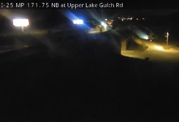
I-25 MP 171.75 NB at Upper Lake Gulch Rd live camera view Verified live · 110s
I-25 MP 171.75 NB at Upper Lake Gulch Rd
· Camera: CDOT · official site · 100% 14-day uptime
I-25
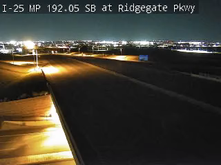
I-25 MP 192.05 SB at Ridgegate Pkwy live camera view Verified live · 110s
I-25 MP 192.05 SB at Ridgegate Pkwy
· Camera: CDOT · official site · 100% 14-day uptime
I-25
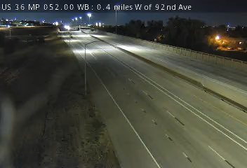
US 36 MP 52.00 WB, 0.4 miles W of 92nd Ave live camera view Verified live · 110s
US 36 MP 52.00 WB, 0.4 miles W of 92nd Ave
· Camera: CDOT · official site · 100% 14-day uptime
US 36
I-25 MP 41.90 SB at Rouse Rd/CR 310 live camera view Verified live · 110s
I-25 MP 41.90 SB at Rouse Rd/CR 310
· Camera: CDOT · official site · 99% 14-day uptime
I-25
I-70 MP 43.75 EB at US 6 in Palisade live camera view Verified live · 110s
I-70 MP 43.75 EB at US 6 in Palisade
· Camera: CDOT · official site · 100% 14-day uptime
I-70
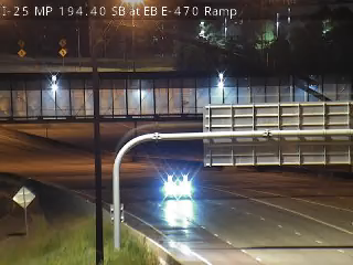
I-25 MP 194.40 SB, SB I-25 Ramp to EB E-470 live camera view Verified · 4m
I-25 MP 194.40 SB, SB I-25 Ramp to EB E-470
· Camera: CDOT · official site · 100% 14-day uptime
I-25
CO 9 MP 127.40 SB, 1.4 miles N of Heeney Rd Green Mountain Reservoir (Road Surface) live camera view Verified live · 110s updates ~every 10 min
CO 9 MP 127.40 SB, 1.4 miles N of Heeney Rd Green Mountain Reservoir (Road Surface)
· Camera: CDOT · official site · 100% 14-day uptime
CO 9
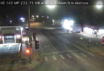
US 160 MP 232.75 WB at US 285/West Ave and Main St in Alamosa (East) live camera view Verified live · 110s updates ~every 10 min
US 160 MP 232.75 WB at US 285/West Ave and Main St in Alamosa (East)
· Camera: CDOT · official site · 100% 14-day uptime
US 160
US 160 MP 202.05 WB at CO 112/Oak St in Del Norte (East) live camera view Verified live · 110s updates ~every 10 min
US 160 MP 202.05 WB at CO 112/Oak St in Del Norte (East)
· Camera: CDOT · official site · 99% 14-day uptime
US 160
US 24 MP 313.20 EB at Marksheffel Rd in Colorado Springs (East) live camera view Verified live · 110s updates ~every 10 min
US 24 MP 313.20 EB at Marksheffel Rd in Colorado Springs (East)
· Camera: CDOT · official site · 100% 14-day uptime
US 24
US 50 MP 97.60 EB, 0.6 miles E of Miguel Rd in Montrose (Roadway) live camera view Verified live · 110s updates ~every 10 min
US 50 MP 97.60 EB, 0.6 miles E of Miguel Rd in Montrose (Roadway)
· Camera: CDOT · official site · 100% 14-day uptime
US 50
CO 145 MP 70.55 SB, 0.8 miles S of Society Dr in Telluride (South) live camera view Verified live · 110s updates ~every 10 min
CO 145 MP 70.55 SB, 0.8 miles S of Society Dr in Telluride (South)
· Camera: CDOT · official site · 100% 14-day uptime
CO 145

Passes, bridges, and tunnels in Colorado

Cities in Colorado

Camera pages in Colorado

Cameras by route

Interstates

US Highways

State Routes

Other roads

Colorado DOT cameras, road conditions & 511

Are these official Colorado DOT cameras?
Yes. Every feed on this page is published by CDOT. They are the same cameras CDOT shows on COtrip.
How do I check Colorado road conditions?
Open a camera along your route for a live look at the pavement and weather. For closures and incident reports, see COtrip. COtrip
Is this the same as Colorado 511?
Colorado's 511 service publishes many of the same cameras alongside closure and incident reports. This page focuses on the cameras and links out for the rest.

Free email, every Monday

Weekly camera uptime digest

How many Colorado cameras were verified live, stale, or dead, and how the week compared with the last. The same numbers as our uptime report, with the same caveats.

LiveTrafficCam <hello@livetrafficcam.com> Camera uptime digest: Colorado, week of 2026-11-23
  • Colorado: 1,167 active cameras.
  • Verified live right now: 1,151 (98.6%).
  • 7-day check pass rate, and the change from the week before.

Built from the numbers on this page right now; Monday's email carries Monday's.

A confirmation link first, nothing before you click it. One email a week, unsubscribe in every one. No sharing, no other mail.