Montana Road Conditions, Closures & Cameras
MDT has 460 road reports on 92 roads. MDT lists 5 closures and 54 other reported events. 427 of the state's 427 cameras showed a live picture in the last 24 hours.
MDT road reports
-
Closed for the season
- MT-49: TWO Medicine to Jct US-89
- US-212: Beartooth Highway - Vista Point to Lower Gate
- US-212: Beartooth Highway - Wyoming State Line to Vista Point
-
Icy
- MT-3: Harlowton to Garneill
-
Slush
- Redstone to Plentywood
-
Snow covered
-
Icy patches
- I-90: 6 to 16 Miles East of Butte Over Homestake Pass
- MT-38: 28 Miles West of GEM Mountain to Jct With MT-1
-
Dry, reduced visibility
- I-15: Conrad to the Junction With MT-44 Valier Interchange
- I-15: The Brady Interchange to Conrad
- MT-44: Valier to the Jct With I-15
-
Slush, reduced visibility
- S-241: TOP of Powell Hill to Turner
- S-241: Turner to Canadian Line
- US-2: 7 Miles West of Marias Pass Over Marias Pass
- US-2: East Side of Marias Pass to East Glacier
- US-2: Malta to Saco
-
Wet, reduced visibility
- MT-24: Opheim to the Canadian Line
- MT-24: St. Marie to Opheim
- S-248: Opheim to the Peerless Turnoff
- S-464: Duck Lake Road - 12 Miles North of Browning to Babb
- US-2: Phillips/Blaine County Line to Malta
- US-2: Pinnacle to Devil Creek
- US-2: West Glacier to Pinnacle
- US-89: Over the Hudson Bay Divide to St. Mary
- US-89: St. Mary to the Canadian Line
- US-89: The Kiowa Jct to Hudson Bay Divide
- US-191: Malta North to Canadian Line
-
Wet
- Culbertson to Medicine Lake
- Medicine Lake to Plentywood
- Scobey to Redstone
- I-94: Glendive to Dawson/Wibaux County Line
- I-94: The Dawson/Prairie County Line to Glendive
- MT-1: Anaconda to Georgetown Lake
- MT-5: Plentywood to the North Dakota Line
- MT-13: 21 Miles North of Circle to the Jct W MT-25 (Including MT-25)
- MT-13: 26 Miles South of Scobey to Scobey
- MT-13: Scobey to the Canadian Line
- MT-16: 18 Miles Northwest of Sidney to Culbertson
- MT-16: Glendive to Savage
- MT-16: Plentywood to the Canadian Line
- MT-49: Jct US-2 to TWO Medicine
- MT-64: JCT W US-191 TO BIG SKY
- MT-66: Hays to Peoples Creek
- MT-66: Peoples Creek to Harlem
- MT-200: 17 Miles Southeast of Circle to Glendive
- MT-200: Jct S-279 (Flesher Pass Road) to Rogers Pass
- MT-200: Rogers Pass
- S-206: MT-35 TO US-2
- S-241: Harlem to TOP of Powell Hill
- S-248: The Peerless Turnoff to Scobey
- US-2: Berne Rd to West Glacier
- US-2: Chinook to Harlem
- US-2: Culbertson to the State Line
- US-2: Harlem to the Phillips County Line
- US-2: Jct With MT-2 to 12.4 Miles N of Jct With MT-2
- US-2: Mcgregor Lake Resort to US-93 ALT Route
- US-2: MT-40 to Berne Rd
- US-2: Poplar to Culbertson
- US-2: Saco to Glasgow
- US-12: 12 Miles East of Townsend Through Deep Creek Canyon
- US-12: Graves Creek to Lolo
- US-12: Lolo Pass Chain UP Area to Graves Creek
- US-89: 2 Miles South of Kings Hill to Neihart
- US-191: The Jct With MT-64 Thru the Gallatin Canyon
- US-191: The Yellowstone Park Boundary to the Jct W MT-64
-
Normal seasonal conditions
- Butte Business Loop
- Jct MT-41 to Ninemile
- Jct of MT-2 to Jct of MT-41 and Mt 55 (Flashing Light)
- Jct With S 244 to the Jct With MT-200 and MT-19
- Ninemile to Jct I-15/I-90 Butte
- Roundup to Jct With S 244
- The Jct With US-87 to 10 Miles North
- I-15: Butte to 13 Miles North
- I-15: Cascade to ULM
- I-15: Clark Canyon DAM to Dillon
- I-15: Dearborn (Cascade CO Line) to Hardy Creek
- I-15: Dillon to Glen
- I-15: Dutton to Brady
- I-15: Feeley Hill Interchange to Butte
- I-15: Glen to Feeley Hill Interchange
- I-15: Great Falls to Vaughn
- I-15: Hardy Creek to Cascade
- I-15: I-115
- I-15: Sieben North to Wolf Creek
- I-15: ULM to Great Falls
- I-15: Vaughn to Dutton
- I-15: Wolf Creek North to Dearborn
- I-90: 15 Miles West of Butte to Nissler Jct
- I-90: 16 Miles East of Butte to Cardwell
- I-90: 9 Miles East of Bozeman Over Bozeman Pass
- I-90: Bearmouth Interchange to Drummond
- I-90: Belgrade to Bozeman (North 7th Interchange)
- I-90: Big Timber to Reed Point
- I-90: Bozeman (N 7th Intchg) to 4 Miles East at the Bear Canyon Interchange
- I-90: Bozeman Pass to Exit 330 - Livingston
- I-90: Cardwell to 10 Miles East (Cottonwood Hill)
- I-90: Deer Lodge to Warm Springs
- I-90: Drummond to Phosphate Jct
- I-90: Exit 330 - Livingston to Exit 337
- I-90: Exit 337 - Livingston to Springdale
- I-90: Manhattan to Belgrade Exit 298 (Jackrabbit Ln)
- I-90: Phosphate to Deer Lodge
- I-90: Springdale to Big Timber
- I-90: The Bear Canyon INT Thru Rocky Canyon to 9 Miles East of Bozeman
- I-90: Warm Springs to 1 Mile East of the Jct With MT-1
- MT-1: Flint Creek Hill to Jct With MT-38
- MT-1: Hall to Drummond
- MT-1: Jct With MT-38 to Hall
- MT-1: The Jct With I-90 to Anaconda
- MT-2: The Cardwell INT to the Jct With US-287 (Jefferson Canyon)
- MT-2: The Jct With MT-41 to Whitehall
- MT-3: Broadview to Lavina
- MT-21: Augusta to Simms
- MT-25: Anaconda St
- MT-38: 14 Miles East of Daly Creek to 28 Miles West of GEM Mountain
- MT-38: Skalkaho - Jct With US-93 to 14 Miles East of Daly Creek
- MT-41: Dillon to the Beaverhead/Madison County Line
- MT-43: 18 Miles West of Wisdom to Big Hole Battlefield
- MT-43: Big Hole Battlefield to Sportsmans Campground
- MT-43: Sportsman Campground to Divide
- MT-43: The Idaho Line to Chief Joseph Pass
- MT-48: Anaconda to Warm Springs
- MT-55: The Jct With MT-41 (North of Silver Star) to Whitehall (Flashing Light)
- MT-69: Whitehall to 21 Miles North
- MT-78: Red Lodge to Roscoe
- MT-78: Roscoe to the Junction With S-419
- MT-80: 15 Miles South of Fort Benton to Square Butte
- MT-80: Jct With MT-81 to Stanford
- MT-80: Junction With US-87 to 15 Miles South of Fort Benton
- MT-80: Square Butte to Jct With MT-81
- MT-81: Denton to the Jct With US-191
- MT-81: Jct With MT-80 to Denton
- MT-83: Clearwater Jct to Seeley Lake
- MT-83: Seeley Lake to Condon
- MT-84: 23 Miles West of Bozeman to Jct W Mt 85 & US 191 (Four Corners)
- MT-85: Jct W Mt 84 & US 191 (Four Corners) to Belgrade
- MT-86: Bozeman to 11 Miles North
- MT-88: Highway 10 S
- MT-141: Jct 271 to Jct With MT-200
- MT-141: Nevada Lake to the Jct With S-271
- 14 Miles East of Lewistown to the Jct With MT-200 and MT-19
- MT-200: 5 Miles West of the Jct With MT-141 to Lincoln
- MT-200: Geyser to Stanford
- MT-200: Grassrange to the Fergus/Petroleum CO Line
- MT-200: Greenough Hill to Clearwater Jct
- MT-200: Lincoln to the Jct With S-279 (Flesher Pass Road)
- MT-200: Simms to the Junction With US-89
- Stanford to the Jct With US-87/MT-200 and US-191S (Eddies Corner)
- MT-200: The Clearwater Jct to N of Helmville Jct
- MT-200: The Fergus/Petroleum CO Line to 37 Miles East of Winnett
- MT-200: The Jct With US-287 (Bowmans Corner) to Simms
- S-203: Stevensville to Florence
- S-223: Chester South to the Chouteau/Liberty County Line
- S-223: Junction With US 87 to the Chouteau/Liberty County Line
- S-232: 24 Miles North of Havre to the Canadian Line
- S-232: Havre to 24 Miles North of Havre
- S-233: Havre to the Canadian Border
- S-239: Utica to Hobson
- S-244: The Jct With US-87 (21 Miles North of Roundup) to Winnett
- S-263: Mullan Road to Frenchtown
- S-269: Hamilton to Stevensville
- S-269: JCT US 93 TO JCT SEC 203
- S-271: Drummond North to Helmville
- S-278: Jct I-15 Over Badger Pass to the Polaris Turnoff
- S-278: The Polaris Turnoff Over Big Hole Pass to Wisdom
- S-279: Bottom of Flesher Pass (MP 24.5) to Jct With Mt 200
- S-308: Red Lodge to Belfry
- S-314: Wyoming Line to the Junction With US 212
- S-348: From Jct With Mt 1 West
- S-370: Bell Crossing
- S-373: Woodside Cutoff
- S-427: The Jct With US-89S to Raynesford
- S-464: Duck Lake Road - Browning to 12 Miles North
- S-541: Utica to Windham
- US-2: Browning to Jct With S 444
- US-2: Chester to Hingham
- US-2: East Glacier to Browning
- US-2: Galata to Chester
- US-2: Havre to Chinook
- US-2: Hingham to the Fresno Turnoff
- US-2: The Fresno Turnoff to Havre
- US-12: Garrison to Avon
- Junction With Mt 3 / US 12 (Lavina Jct) to Roundup
- US-12: Melstone to Ingomar
- US-12: Roundup to Musselshell
- Ryegate to Junction US-12 (Lavina Junction)
- US-12: Shawmut to Ryegate
- US-87: 10 Miles North of Loma to Big Sandy
- US-87: 29 Miles South of Roundup to Roundup
- US-87: Big Sandy to BOX Elder
- US-87: BOX Elder to Havre
- US-87: Carter to Fort Benton
- US-87: Fort Benton to Loma
- US-87: Great Falls to the Cascade/Chouteau County Line
- US-87: Loma to 10 Miles North
- US-87: The Cascade/Chouteau County Line to Carter
- US-89: 10 Miles South of Livingston to Livingston
- US-89: Betts Hill to Fairfield
- US-89: Browning to the Kiowa Jct
- US-89: Rangers Station to Monarch Canyon
- US-89: The Jct With S-227 (Sand Coulee Jct) to Great Falls
- US-89: TWO Medicine Creek (South of Browning) to Browning
- US-89: Vaughn to Betts Hill
- US-93: Conner to Hamilton
- US-93: Evaro to Arlee
- US-93: Florence to Bitterroot River
- US-93: Hamilton to the Stevensville Turnoff
- US-93: Lost Trail Pass to Sula
- US-93: Sula to Conner
- US-93: WYE to Evaro Hill
- US-191: Big Timber to Melville
- US-191: Jct W Mt 84 & Mt 85 (Four Corners) to Bozeman
- US-212: Beartooth Highway - Lower Gate to Red Lodge
- US-212: Crow Agency to Lame Deer
- US-212: Red Lodge to Roberts
- US-212: Roberts to Rockvale
- US-287: Augusta to Junction With S-408
- US-287: Jct With S-408 to 12 Miles North of Augusta
- US-287: The Jct With MT-200 (Bowmans Corner) to Augusta
- US-287: Wolf Creek to 8 Miles North
-
Dry
- 10 Miles North of Grassrange to the Jct With US-191
- 39 Miles Southwest of Malta (Zortman Road) to Malta
- 5 Miles South of the Fred Robinson Bridge to the Jct With Mt 66
- Ennis Over Virginia City Hill to Virginia City
- Jct MT-78 to County Line
- Jct With MT-35 E to Jct With MT-83
- The Jct With Mt 66 to 16 Miles North
- The Jct With MT-19 to 17 Miles North
- Twin Bridges North to Jct of MT-41 and MT-55 (Flashing Light)
- Virginia City North to Twin Bridges
- I-15: Airport Rd (Havre)
- I-15: Boulder to Clancy
- I-15: Clancy to Montana City
- I-15: Elk Park to Boulder
- I-15: Jct With S 215 to Sunburst
- I-15: Lima to Clark Canyon DAM
- I-15: Monida Pass (Idaho Side)
- I-15: Monida Pass (Montana Side) to Lima
- I-15: Montana City to the Lincoln Interchange
- I-15: Shelby to the Junction With S 215
- I-15: Sunburst to the Canadian Line
- I-15: The Lincoln Interchange to 16 Miles North of Helena (Sieben Interchange)
- I-15: The Valier Interchange to Shelby
- I-90: 12 Miles East of Billings to 19 Miles East of Billings
- I-90: 19 Miles East of Billings to Hardin
- I-90: 8 Miles South of Crow Agency to Wyola
- I-90: Alberton to Frenchtown
- I-90: Beavertail to Bearmouth Interchange
- I-90: Bonner Jct to Beavertail
- I-90: Columbus to Park City
- I-90: Exit 443 (ZOO Dr) to Exit 456 (I-94 Interchange)
- I-90: Exit 456 (I-94 Interchange) to 12 Miles East of Billings
- I-90: Frenchtown to Bonner
- I-90: Hardin to 8 Miles South of Crow Agency
- I-90: Haugan to St Regis
- I-90: Lookout Pass to Taft
- I-90: Park City to ZOO Drive Interchange
- I-90: Reedpoint to Columbus
- I-90: St. Regis to Superior
- I-90: Superior to Tarkio
- I-90: Taft to Haugan
- I-90: Tarkio to Alberton
- I-90: The Jct With US-287 to Manhattan
- I-90: The Milligan Canyon INT to the Jct With US-287 (Reno Hill)
- I-90: W Broadway St
- I-90: Wyola to the Wyoming State Line
- I-94: Ballantine to Big Horn
- I-94: Big Horn to the Rosebud/Treasure County Line
- I-94: Billings to Ballantine
- I-94: Dawson/Wibaux County Line to Wibaux
- I-94: Forsyth to the Hathaway Rest Area
- I-94: Miles City to the Diamond Ring Interchange
- I-94: Terry to the Dawson/Prairie County Line
- I-94: The Diamond Ring Interchange to Terry
- I-94: The Hathaway Rest Area to Miles City
- I-94: The Rosebud/Treasure County Line to Forsyth
- I-94: Wibaux to the North Dakota Line
- MT-3: Billings to Broadview
- MT-3: Garneill to the Jct With US-87
- MT-7: Baker to the Fallon/Wibaux County Line
- MT-7: Ekalaka to Baker
- MT-7: Fallon/Wibaux County Line to Wibaux
- MT-13: Circle to 21 Miles North
- MT-13: The Jct of MT-25 to 26 Miles South of Scobey
- MT-16: Savage to Sidney
- MT-16: Sidney to 18 Miles Northwest
- MT-16: Sidney to Fairview
- MT-23: Sidney to the North Dakota Line
- MT-24: 32 Miles North of the Jct of MT-200 to Glasgow
- MT-24: Glasgow to St. Marie
- MT-24: The Jct With MT-200 to 32 Miles North
- MT-28: Lonepine to Elmo
- MT-28: Rainbow Lake to Lonepine
- MT-28: The Jct With MT-200 to 10 Miles North
- MT-35: Bigfork to Kalispell
- MT-35: Polson to Yellow Bay
- MT-35: Yellow Bay to Bigfork
- MT-37: Libby to Sheep CRK
- MT-37: Sheep CRK to Eureka
- MT-39: Colstrip to the Jct With I-94
- MT-39: Lame Deer to Colstrip
- MT-40: US-93 TO US-2
- MT-41: Beaverhead/Madison County Line to Twin Bridges
- MT-44: The Jct With US-89 to Valier
- MT-47: 11 Miles North of Hardin to Custer
- MT-47: Hardin to 11 Miles North
- MT-56: Bull Lake to Troy
- MT-56: Noxon to Bull Lake
- MT-59: 45 Miles Northwest of Miles City to Jordan
- MT-59: Broadus to Coalwood
- MT-59: Broadus to Hammond
- MT-59: Coalwood to Miles City
- MT-59: Hammond to the Wyoming Line
- MT-59: Miles City to 45 Miles Northwest
- MT-59: The Wyoming Line to Broadus
- MT-66: The Jct With US-191 to Hays
- MT-69: 21 Miles North of Whitehall to Boulder
- MT-72: The Wyoming Line to Bridger
- MT-78: Junction With S-419 to the Junction With I-90 at Columbus
- MT-82: Somers to MT-35
- MT-83: Condon to S-209
- MT-83: S-209 TO MT-35
- MT-84: Norris to 23 Miles West of Bozeman
- MT-86: 11 Miles to 21.5 Miles North of Bozeman
- MT-86: 21.5 Miles North of Bozeman to Jct W US-89
- MT-117: Jct With MT-24 (Fort Peck Lake) to Nashua
- MT-135: St. Regis to the Jct With MT-200
- MT-141: Avon to Nevada Lake
- MT-200: 14 Miles East of Jordan to the Jct With MT-24
- MT-200: 38.5 Miles West of Jordan to Jordan
- MT-200: Bonner to Greenough Hill-Blackfoot
- MT-200: Brockway to Circle
- MT-200: Circle to 17 Miles Southeast
- MT-200: Circle to Lambert
- MT-200: Geyser to the Jct With US-89 (Armington Jct)
- MT-200: Idaho St Line to Trout Creek
- MT-200: Jct MT-135 to West of Dixon
- MT-200: Jct S-434 to Jct US-287 (Bowmans Corner)
- MT-200: Jct With Mt 3 (Eddies Corner) to Lewistown
- MT-200: Jordan to 14 Miles East
- MT-200: Lambert to Sidney
- MT-200: Lewistown to 14 Miles East
- MT-200: Rogers Pass to the Jct With S-434
- MT-200: The Jct With MT-24 to Brockway
- MT-200: Thompson Falls to Plains
- MT-200: Trout Creek to Thompson Falls
- MT-200: West of Dixon to Ravalli
- MT-200: West of Plains to Jct MT-135
- S-201: Jct With MT-16 to State Line
- S-211: Jct of US 93 at Ronan W to HOT Springs
- S-212: 4 Miles North of Dixon to Moise
- S-212: Moise to the Jct With US-93 South of Ronan
- S-213: CUT Bank to the Canadian Line
- S-236: Hilger to Winifred
- S-253: 23 Miles North of Terry to Jct MT-200
- S-253: Jct I-94 to 23 Miles North of Terry
- S-263: Mullan Road
- S-271: 3 Miles West of Helmville to Jct With Mt 141
- S-279: Lincoln Road to 22 Miles W (Bottom of Flesher Pass)
- S-294: Lennep Road - Jct US 89 to Jct US 12
- S-323: 51 Miles South of Ekalaka to Alzada
- S-323: Ekalaka to 51 Miles South
- S-359: Cardwell Road - I 90 Bridges to Jct US 287
- S-382: MT-200 TO MT-28
- S-416: Billings Pryor Rd
- S-419: Junction With Mt 78 to NYE
- S-424: Farm to Market / Kalispell to Lodgepole Rd
- S-424: Lodgepole / Twin Bridges to US-93
- S-471: Thompson Pass Road - 16 Miles West Continuing to Mt/ID State Line
- S-471: Thompson Pass Road - Jct With MT-200 to 16 Miles West
- US-2: CUT Bank to Ethridge
- US-2: Ethridge to Shelby
- US-2: Glasgow to Nashua
- US-2: Happy'S INN to Mcgregor Lake Resort
- US-2: Idaho St Line to Williams CRK
- Jct US-2 to Yaak
- US-2: Jct With S 444 to CUT Bank
- US-2: Nashua to Wolf Point
- US-2: Schreiber CRK to Happy'S INN
- US-2: Shelby to Galata
- US-2: US-93 ALT Route to MT-40
- US-2: Williams CRK to Schreiber CRK
- US-2: Wolf Point to Poplar
- US-12: Avon to Macdonald Pass
- US-12: Baker to the North Dakota Line
- US-12: Deep Creek Canyon to the Jct With US-89
- US-12: Harlowton to Shawmut
- US-12: Helena to the Canyon Ferry Turnoff
- US-12: Ingomar to Forsyth
- US-12: Jct W US 89 to 35 Miles East of White Sulphur Springs
- US-12: Macdonald Pass
- US-12: Macdonald Pass to Helena
- US-12: Miles City to Powder River MM 31.5
- US-12: Musselshell to Melstone
- US-12: Powder River to Baker
- US-12: The Canyon Ferry Turnoff to Townsend
- US-12: The Jct With I-90 to Toston (Kamp Hill)
- US-12: Toston to Townsend
- US-12: Townsend to 12 Miles East
- US-12: Wheatland/Meagher County Line to Harlowton
- US-20: 1 Mile East of the Idaho Line to West Yellowstone
- US-20: Targhee Pass
- US-87: Billings to 19 Miles North
- US-89: 16 Miles North of Gardiner to Emigrant
- US-89: Bynum to the Jct S-219 (Pendroy Jct)
- US-89: Chouteau to Bynum
- US-89: Dupuyer to Jct MT-44
- US-89: Emigrant to 10 Miles South of Livingston
- US-89: Fairfield to Choteau
- US-89: Gardiner Through Yankee JIM Canyon to 16 Miles North of Gardiner
- US-89: Jct MT-44 to TWO Medicine Bridge
- Jct W US 89 (Armington Jct) to the Jct W S-227 (Sand Coulee Jct)
- US-89: Jct With I-90 to the Junction With MT-86
- US-89: Junction With MT-86 to the Park/Meagher County Line
- US-89: MM 15 to the Foot of Kings Hill
- US-89: Neihart to Rangers Station
- US-89: Park/Meagher County Line to White Sulphur Springs
- US-89: Riceville Hill to the Jct With US-87/89E (Armington Jct)
- US-89: The Jct With S-427 (Monarch Canyon) to Riceville Hill
- US-89: The Pendroy Jct to Dupuyer
Reports by road (92 roads)
- I-15: Dry, reduced visibility 2 · Dry 13 · Normal seasonal conditions 15
- I-90: Icy patches 1 · Normal seasonal conditions 18 · Dry 23
- I-94: Wet 2 · Dry 11
- MT-1: Wet 1 · Normal seasonal conditions 4
- MT-2: Normal seasonal conditions 2
- MT-3: Icy 1 · Normal seasonal conditions 1 · Dry 2
- MT-5: Wet 1
- MT-7: Dry 3
- MT-13: Dry 2 · Wet 3
- MT-16: Dry 3 · Wet 3
- MT-21: Normal seasonal conditions 1
- MT-23: Dry 1
- MT-24: Wet, reduced visibility 2 · Dry 3
- MT-25: Normal seasonal conditions 1
- MT-28: Dry 3
- MT-35: Dry 3
- MT-37: Dry 2
- MT-38: Icy patches 1 · Normal seasonal conditions 2
- MT-39: Dry 2
- MT-40: Dry 1
- MT-41: Dry 1 · Normal seasonal conditions 1
- MT-43: Normal seasonal conditions 4
- MT-44: Dry 1 · Dry, reduced visibility 1
- MT-47: Dry 2
- MT-48: Normal seasonal conditions 1
- MT-49: Closed for the season 1 · Wet 1
- MT-55: Normal seasonal conditions 1
- MT-56: Dry 2
- MT-59: Dry 7
- MT-64: Wet 1
- MT-66: Dry 1 · Wet 2
- MT-69: Dry 1 · Normal seasonal conditions 1
- MT-72: Dry 1
- MT-78: Dry 1 · Normal seasonal conditions 2
- MT-80: Normal seasonal conditions 4
- MT-81: Normal seasonal conditions 2
- MT-82: Dry 1
- MT-83: Dry 2 · Normal seasonal conditions 2
- MT-84: Dry 1 · Normal seasonal conditions 1
- MT-85: Normal seasonal conditions 1
- MT-86: Normal seasonal conditions 1 · Dry 2
- MT-88: Normal seasonal conditions 1
- MT-117: Dry 1
- MT-135: Dry 1
- MT-141: Dry 1 · Normal seasonal conditions 2
- MT-200: Wet 3 · Normal seasonal conditions 11 · Dry 20
- S-201: Dry 1
- S-203: Normal seasonal conditions 1
- S-206: Wet 1
- S-211: Dry 1
- S-212: Dry 2
- S-213: Dry 1
- S-223: Normal seasonal conditions 2
- S-232: Normal seasonal conditions 2
- S-233: Normal seasonal conditions 1
- S-236: Dry 1
- S-239: Normal seasonal conditions 1
- S-241: Wet 1 · Slush, reduced visibility 2
- S-244: Normal seasonal conditions 1
- S-248: Wet 1 · Wet, reduced visibility 1
- S-253: Dry 2
- S-263: Dry 1 · Normal seasonal conditions 1
- S-269: Normal seasonal conditions 2
- S-271: Dry 1 · Normal seasonal conditions 1
- S-278: Normal seasonal conditions 2
- S-279: Dry 1 · Normal seasonal conditions 1
- S-294: Dry 1
- S-308: Normal seasonal conditions 1
- S-314: Normal seasonal conditions 1
- S-323: Dry 2
- S-348: Normal seasonal conditions 1
- S-359: Dry 1
- S-370: Normal seasonal conditions 1
- S-373: Normal seasonal conditions 1
- S-382: Dry 1
- S-416: Dry 1
- S-419: Dry 1
- S-424: Dry 2
- S-427: Normal seasonal conditions 1
- S-464: Normal seasonal conditions 1 · Wet, reduced visibility 1
- S-471: Dry 2
- S-541: Normal seasonal conditions 1
- US-2: Slush, reduced visibility 3 · Wet, reduced visibility 3 · Normal seasonal conditions 7 · Wet 9 · Dry 13
- US-12: Snow covered 1 · Wet 3 · Normal seasonal conditions 6 · Dry 17
- US-20: Dry 2
- US-87: Dry 1 · Normal seasonal conditions 9
- US-89: Wet 1 · Wet, reduced visibility 3 · Normal seasonal conditions 7 · Dry 18
- US-93: Normal seasonal conditions 7 · Dry 13
- US-191: Wet, reduced visibility 1 · Normal seasonal conditions 2 · Wet 2 · Dry 6
- US-212: Closed for the season 2 · Dry 3 · Normal seasonal conditions 4
- US-287: Normal seasonal conditions 4 · Dry 14
- US-310: Dry 3
Closures and reported events
- Full closure: N HIGHWAY 91: road closed until further notice.
- Full closure: 2nd Street East: road closed with detour until 6:00 PM Friday, August 6, 2027.
- Full closure: S-482 from MP 2.5 to 2.7: road closed until 5:00 PM Friday, May 28, 2027.
- Full closure: S-482 from MP 2.0 to 3.0: road closed and Critical incident flood until further notice.
- Full closure: undefined: road closed and Critical incident flood until further notice.
54 other reported events (incidents, roadwork and alerts), by road
Live cameras on Montana roads
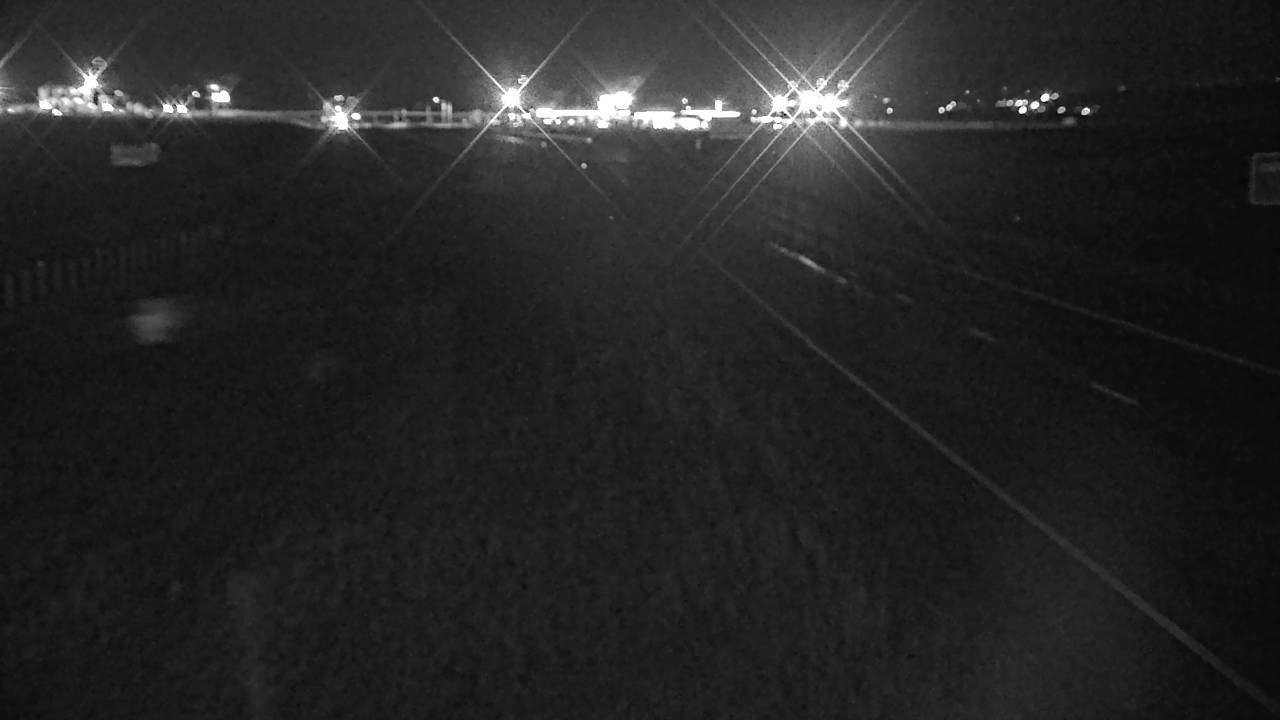 Verified · 5m updates ~every 20 min
 Verified · 9m updates ~every 20 min
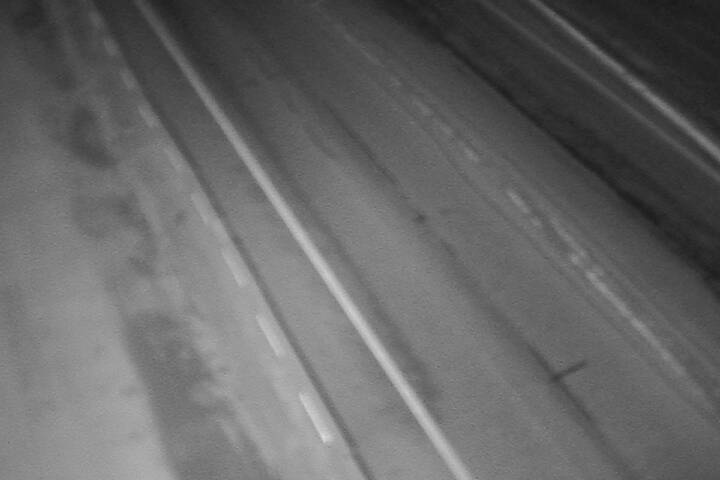 Verified · 9m updates ~every 20 min
 Verified · 9m updates ~every 20 min
 Verified · 9m updates ~every 20 min
 Verified · 9m updates ~every 20 min
 Verified · 10m updates ~every 20 min
 Verified · 10m updates ~every 20 min
 Verified · 10m updates ~every 20 min
 Verified · 10m updates ~every 20 min
 Verified · 10m updates ~every 20 min
 Verified · 10m updates ~every 20 min
Passes, bridges and tunnels in Montana
- Homestake Pass cameras
- MacDonald Pass cameras
- Rogers Pass cameras
- Bozeman Pass cameras
- Monida Pass cameras
- Glacier National Park cameras
- Bridger Canyon cameras
- Raynolds Pass cameras
- Big Hole Pass cameras
- Flesher Pass cameras