California Road Conditions, Closures & Cameras
Caltrans has 934 road reports on 68 roads. Caltrans lists 71 closures and 132 other reported events. 2,662 of the state's 2,778 cameras showed a live picture in the last 24 hours.
Caltrans road reports
-
No chain controls are in effect at this time.
- I-5: 10 miles north of Redding (Fawndale) (northbound)
- I-5: 14.5 miles north of Central Yreka (southbound)
- I-5: 16 miles south of Dunsmuir (northbound)
- I-5: 19 miles south of Dunsmuir (northbound)
- I-5: 2 miles north of Mt Shasta (Watch Sign Only) (northbound)
- I-5: 24 miles north of Redding (Antlers) (southbound)
- I-5: 26 miles north of Redding (Lakehead) (northbound)
- I-5: 3 miles north of Weed (Edgewood) (southbound)
- I-5: 3 miles north of Yreka (northbound)
- I-5: 3 miles south of Dunsmuir (South Dunsmuir) (northbound)
- I-5: 3 miles south of Dunsmuir (Watch Sign Only) (southbound)
- I-5: 4 miles north of Dunsmuir (Mott Road) (northbound)
- I-5: 6 miles south of Dunsmuir (Watch Sign Only) (northbound)
- I-5: 6 miles south of Oregon State Line (northbound)
- I-5: ANDERSON GRADE (3,067 ft) (*bound)
- I-5: BAILEY HILL (*bound)
- I-5: BLACK BUTTE SUMMIT (3,917 ft)
- I-5: Castaic Junction (northbound)
- I-5: Dunsmuir (Watch Sign Only) (northbound)
- I-5: Frazier Mtn Park Rd (northbound)
- I-5: Grapevine (northbound)
- I-5: HILT INTERCHANGE (NB) (*bound)
- I-5: Hungry Valley Road (northbound)
- I-5: LA-Kern countyline (northbound)
- I-5: Lake Hughes Road (eastbound)
- I-5: NORTH YREKA INTERCHANGE (NB) (northbound)
- I-5: Sims Road NB Off Ramp (northbound)
- I-5: SOUTH YREKA INTERCHANGE (SB) (southbound)
- I-5: Weed (South Weed) (southbound)
- I-8: JWO E. Willows RD (eastbound)
- I-8: WO Ocotillo (westbound)
- I-15: Devore Jct. 215/15 thru to Main St in Hesperia (northbound)
- I-15: Halloran Springs thru to State Line (northbound)
- I-40: Donner Summit Canyon (westbound)
- I-40: Pacific Crest Trail (eastbound)
- I-80: Alta (eastbound)
- I-80: Alta (westbound)
- I-80: Applegate - End of Control (westbound)
- I-80: Applegate (eastbound)
- I-80: Baxter (eastbound)
- I-80: Baxter (westbound)
- I-80: Boca (eastbound)
- I-80: Boca (westbound)
- I-80: CA / NV Stateline - Gold Ranch (westbound)
- I-80: CA / NV Stateline- Gold Ranch (End of Control) (eastbound)
- I-80: Castle Peak, (@ DRA Holding only) (eastbound)
- I-80: Cisco Grove (eastbound)
- I-80: Cisco Grove (westbound)
- I-80: Colfax (eastbound)
- I-80: Colfax (westbound)
- I-80: DLI (Donner Lake Interchange) (eastbound)
- I-80: DLI (Donner Lake Interchange) (westbound)
- I-80: Drum (eastbound)
- I-80: Drum (Whitmore) (westbound)
- I-80: Eagle Lakes (westbound)
- I-80: Floriston On-ramp (eastbound)
- I-80: Floriston On-ramp (westbound)
- I-80: Gold Run (eastbound)
- I-80: Gold Run (westbound)
- I-80: Kingvale (eastbound)
- I-80: Kingvale (westbound)
- I-80: Mogul (westbound)
- I-80: Nyack (eastbound)
- I-80: Nyack (westbound)
- I-80: Overland Trail - OTL Truck Screens (westbound)
- I-80: Rainbow (eastbound)
- I-80: Rainbow (westbound)
- I-80: Truckee (eastbound)
- I-80: Truckee (westbound)
- I-80: Whitmore (eastbound)
- I-80: Yuba Gap (eastbound)
- SR-1: 1/4 mile west of Hales Grove (northbound)
- SR-1: west of Legget intersection (southbound)
- SR-2: 1 mile East of Newcomb's Ranch (Gate) (eastbound)
- SR-2: 3 miles East of Newcomb's Ranch (Gate) (eastbound)
- SR-2: 5 miles West of Big Pines thru to LA/SBD Co Line (eastbound)
- SR-2: Charlton Flats rest stop (eastbound)
- SR-2: Georges Gap (eastbound)
- SR-2: Islip Saddle (Gate), Jct SR 39 (eastbound)
- SR-2: Jct. 39 Islip Saddle thru to 5 miles West of Big Pines (eastbound)
- SR-2: Kratka Ridge - ski area (Gate) (eastbound)
- SR-2: La Canada (Gate) (eastbound)
- SR-2: LA/SBD Co Line thru to Jct. SR 138 (eastbound)
- SR-2: Mt. Wilson Rd - Red Box picnic area (eastbound)
- SR-2: Shortcut picnic area (eastbound)
- SR-3: 1 mile north of Trinity Center (Watch Sign Only) (northbound)
- SR-3: 1 mile north of Weaverville (Watch Sign Only) (northbound)
- SR-3: 1 mile south of Douglas City (southbound)
- SR-3: 11 miles north of Trinity Center (northbound)
- 2 miles south of Junction I 5 and SR 3 (southbound)
- SR-3: 3.3 miles south of Callahan (southbound)
- SR-3: 5 miles south of Douglas City (southbound)
- SR-3: 6 miles north of Fort Jones (northbound)
- SR-3: 7 miles north of Hayfork (northbound)
- SR-3: 7 miles north of Weaverville (Watch Sign Only) (northbound)
- SR-3: 7 miles north of Weaverville (Watch Sign Only) (southbound)
- SR-3: 8 miles south of Douglas City (southbound)
- SR-3: 9 miles north of Hayfork (northbound)
- SR-3: FOREST MOUNTAIN (4,097 ft.) (*bound)
- SR-3: HAYFORK MOUNTAIN (3,654 ft) (*bound)
- SR-3: SCOTT MOUNTAIN (5,052 ft) (northbound)
- SR-3: Trinity Center (Watch Sign Only) (southbound)
- SR-4: ARNOLD (eastbound)
- SR-4: ARNOLD (westbound)
- SR-4: BEAR VALLEY (eastbound)
- SR-4: BEAR VALLEY (westbound)
- SR-4: BIG MEADOWS (eastbound)
- SR-4: BIG TREES PARK (eastbound)
- SR-4: BLUE LAKE SPRINGS (eastbound)
- SR-4: BLUE LAKE SPRINGS (westbound)
- SR-4: CAMP CONNEL VILLA (eastbound)
- SR-4: COTTAGE SPRINGS (eastbound)
- SR-4: COTTAGE SPRINGS (westbound)
- SR-4: DORRINGTON (westbound)
- SR-4: DOUGLAS FLAT (eastbound)
- SR-4: EAST END OF LAKE ALPINE - EBBETTS PASS (eastbound)
- SR-4: HANFORD HILL (eastbound)
- SR-4: HATHAWAY PINES (eastbound)
- SR-4: HATHAWAY PINES (westbound)
- SR-4: INDIAN SPRINGS (eastbound)
- SR-4: JCT HWY 89 - EBBETTS PASS (westbound)
- SR-4: MILL CREEK (eastbound)
- SR-4: MOUNT REBA ROAD - EBBETTS PASS (eastbound)
- SR-4: MOUNT REBA ROAD (westbound)
- SR-4: MURPHY'S (eastbound)
- SR-4: POISON SPRINGS (eastbound)
- SR-4: POISON SPRINGS (westbound)
- SR-4: RAYMOND MEADOWS - EBBETTS PASS (westbound)
- SR-4: TAMARACK (eastbound)
- SR-4: TAMARACK (westbound)
- SR-4: TIPTON HOUSE (eastbound)
- SR-4: WOLF CREEK - EBBETTS PASS (westbound)
- SR-14: Agua Dulce Road (northbound)
- SR-14: N Abbot Dr. / 27 Mi. N of Mojave (northbound)
- SR-14: Palmdale Blvd (northbound)
- SR-14: Red Rover Mine Road (northbound)
- SR-14: S Jct. 178 / Freeman Junction (southbound)
- SR-14: Shadow Pines Blvd (northbound)
- SR-14: Soledad Canyon Overcrossing (northbound)
- SR-18: .5 miles East of Jct. SR 330 thru to Green Valley Road (northbound)
- SR-18: .5 miles South of Smart Ranch Rd thru to Greenway Dr (southbound)
- SR-18: 1 mile North of Smart Ranch Rd thru to .5 miles South of Smart Ranch Rd (southbound)
- SR-18: 1.5mi S/O Upper Waterman Cyn. Rd thru to Upper Waterman Cyn. Rd (northbound)
- SR-18: 4000 Ft Level (1mi S/O Jct 138) thru to SR 138 (Crestline IC) (northbound)
- SR-18: Arrowhead Highland Summit thru to Santas Village (northbound)
- SR-18: Arrowhead Ranch thru to Santas Village (southbound)
- SR-18: Big Bear Dam (Jct 38) thru to Pine Knot Ave (northbound)
- SR-18: Big Bear Dam thru to Snow Valley (southbound)
- SR-18: Boulder Bay (0.2 Mi S/O Blue Jay Dr) thru to Big Bear Dam (Jct 38) (southbound)
- SR-18: Green Valley Road thru to Snow Valley (northbound)
- SR-18: Heaps Peak Dump thru to Jct. SR 330 (northbound)
- Jct SR 189 [Cliffhanger] thru to 4000 Ft Level (1mi S/O Jct 138) [Manned] (southbound)
- Jct. SR 189 thru to Arrowhead Highland Summit (northbound)
- SR-18: Johnson Summit (0.5 Mi N/O Baldwin Lake Rd) thru to Mitsubishi/Forest Boundary (northbound)
- SR-18: Lower Waterman Cyn. thru to Vista Point (northbound)
- SR-18: Modoc Dr thru to Boulder Bay - Castle Rock Turnout (southbound)
- SR-18: Mormon Springs thru to Sbd City Limits (southbound)
- SR-18: Paradise Way thru to Mitsubishi Cement Plant/Forest Boundary (northbound)
- SR-18: Pine Knot Ave thru to Greenway Dr (southbound)
- SR-18: Running Springs thru to Arrowhead Ranch (southbound)
- SR-18: Santa's Village thru to Heaps Peak Dump (northbound)
- SR-18: Snow Valley thru to Big Bear Dam (northbound)
- SR-18: Snow Valley thru to Jct SR-330 (southbound)
- SR 138 (Crestline IC) thru to Jct SR 189 (northbound)
- SR-18: Summit Blvd thru to Modoc Dr (southbound)
- SR-18: Top of Johnson thru to 1 mile North of Smart Ranch Rd (southbound)
- SR-18: Upper Waterman Cyn. Rd thru to 4000 Ft Level (1mi S/O Jct 138) (northbound)
- SR-18: Vista Point thru to 1.5mi S/O Upper Waterman Cyn. Rd (northbound)
- SR-20: .6 Miles west of LAK-COL Co Line (eastbound)
- SR-20: .6 Miles west of LAK-COL Co Line (westbound)
- SR-20: .8 Miles east of MEN-LAK Co Line (westbound)
- SR-20: 0.2 Miles west of Junction LAK-29 (westbound)
- SR-20: 1 Mile west of MEN-LAK Co Line (eastbound)
- SR-20: 1.4 Miles west of LAK-COL Co Line (eastbound)
- SR-20: 1.7 Miles west of MEN-LAK Co Line (eastbound)
- SR-20: 20/80 Junction (westbound)
- SR-20: 4 Miles west of Willits (westbound)
- SR-20: 4.4 Miles west of LAK-COL Co Line (westbound)
- SR-20: 5.4 Miles west of LAK-COL Co Line (eastbound)
- SR-20: 5.5 Miles west of LAK-COL Co Line (eastbound)
- SR-20: 6.48 Miles west of LAK-COL Co Line (eastbound)
- SR-20: 7 Miles west of Willits (eastbound)
- SR-20: At the LAK-COL Co Line (westbound)
- SR-20: Auburn St. On-Ramp (westbound)
- SR-20: Bear Creek Bridge - 3 Miles e/o lake/col co line (westbound)
- SR-20: Bear Valley - 4 Miles w/o 20/80 Jct (eastbound)
- SR-20: Bear Valley - 4 Miles w/o 20/80 Jct (westbound)
- SR-20: Bennet St. On-Ramp, End of (eastbound)
- SR-20: Brunswick Rd. On-Ramp (EB), End of (eastbound)
- SR-20: Brunswick Rd. On-Ramp (WB), End of (westbound)
- SR-20: Col/ Lake Co Line - .5 Miles West Co Line (eastbound)
- SR-20: Coyote St. On-Ramp, End of (westbound)
- SR-20: Dana's - 11 Miles e/o Nevada City (eastbound)
- SR-20: Dana's - 11 Miles e/o Nevada City (westbound)
- SR-20: Dorsey Dr. OC (westbound)
- SR-20: End of Frwy (1 Mile east of Nevada City) (eastbound)
- SR-20: Five Mile house - 5 Miles e/o Nevada City (eastbound)
- SR-20: Five Mile house - 5 Miles e/o Nevada City (westbound)
- SR-20: Gold Flat On-Ramp (EB) (eastbound)
- SR-20: Gold Flat On-Ramp (WB) (westbound)
Reports by road (68 roads)
- I-5: No chain controls are in effect at this time. 29
- I-8: No chain controls are in effect at this time. 2
- I-15: No chain controls are in effect at this time. 2
- I-40: No chain controls are in effect at this time. 2
- I-80: No chain controls are in effect at this time. 36
- SR-1: No chain controls are in effect at this time. 2
- SR-2: No chain controls are in effect at this time. 12
- SR-3: No chain controls are in effect at this time. 17
- SR-4: No chain controls are in effect at this time. 30
- SR-14: No chain controls are in effect at this time. 7
- SR-18: No chain controls are in effect at this time. 29
- SR-20: No chain controls are in effect at this time. 47
- SR-26: No chain controls are in effect at this time. 10
- SR-28: No chain controls are in effect at this time. 4
- SR-29: No chain controls are in effect at this time. 15
- SR-32: No chain controls are in effect at this time. 10
- SR-33: No chain controls are in effect at this time. 7
- SR-36: No chain controls are in effect at this time. 29
- SR-38: No chain controls are in effect at this time. 17
- SR-39: No chain controls are in effect at this time. 6
- SR-41: No chain controls are in effect at this time. 11
- SR-44: No chain controls are in effect at this time. 12
- SR-49: No chain controls are in effect at this time. 51
- SR-70: No chain controls are in effect at this time. 31
- SR-74: No chain controls are in effect at this time. 3
- SR-78: No chain controls are in effect at this time. 3
- SR-79: No chain controls are in effect at this time. 6
- SR-88: No chain controls are in effect at this time. 32
- SR-89: No chain controls are in effect at this time. 47
- SR-96: No chain controls are in effect at this time. 3
- SR-108: No chain controls are in effect at this time. 39
- SR-120: No chain controls are in effect at this time. 19
- SR-138: No chain controls are in effect at this time. 14
- SR-139: No chain controls are in effect at this time. 6
- SR-140: No chain controls are in effect at this time. 7
- SR-151: No chain controls are in effect at this time. 1
- SR-155: No chain controls are in effect at this time. 9
- SR-158: No chain controls are in effect at this time. 8
- SR-162: No chain controls are in effect at this time. 2
- SR-167: No chain controls are in effect at this time. 1
- SR-168: No chain controls are in effect at this time. 29
- SR-172: No chain controls are in effect at this time. 1
- SR-173: No chain controls are in effect at this time. 4
- SR-174: No chain controls are in effect at this time. 4
- SR-175: No chain controls are in effect at this time. 9
- SR-178: No chain controls are in effect at this time. 6
- SR-180: No chain controls are in effect at this time. 10
- SR-189: No chain controls are in effect at this time. 1
- SR-190: No chain controls are in effect at this time. 10
- SR-191: No chain controls are in effect at this time. 2
- SR-203: No chain controls are in effect at this time. 8
- SR-207: No chain controls are in effect at this time. 2
- SR-243: No chain controls are in effect at this time. 4
- SR-245: No chain controls are in effect at this time. 6
- SR-253: No chain controls are in effect at this time. 2
- SR-263: No chain controls are in effect at this time. 1
- SR-267: No chain controls are in effect at this time. 5
- SR-270: No chain controls are in effect at this time. 1
- SR-281: No chain controls are in effect at this time. 1
- SR-299: No chain controls are in effect at this time. 57
- SR-330: No chain controls are in effect at this time. 4
- SR-371: No chain controls are in effect at this time. 2
- US-6: No chain controls are in effect at this time. 6
- US-50: No chain controls are in effect at this time. 18
- US-97: No chain controls are in effect at this time. 11
- US-101: No chain controls are in effect at this time. 31
- US-199: No chain controls are in effect at this time. 3
- US-395: No chain controls are in effect at this time. 78
Closures and reported events
- Full closure on I-5: Closure for highway construction on I-5 (northbound) near San Clemente. Lanes closed: All.
- Full closure on I-10: Closure for emergency work on I-10 (eastbound) near Indio. Lanes closed: All.
- Full closure on I-10: Closure for emergency work on I-10 (westbound) near Indio. Lanes closed: All.
- Full closure on SR-91: Closure for bridge work on SR-91 (eastbound) near Anaheim. Lanes closed: All.
- Full closure on I-10: Closure for drainage work on I-10 (westbound) near Beaumont. Lanes closed: All.
- Full closure on I-710: Closure for curb & gutter work on I-710 (northbound) near Bell Gardens. Lanes closed: All.
- Full closure: Closure for emergency work on US-95 (both directions) near Blythe. Lanes closed: All.
- Full closure: Closure for emergency work on SR-62 (both directions) near Twentynine Palms. Lanes closed: All.
- Full closure on I-5: Closure for accident investigation on I-5 (southbound) near Pacoima. Lanes closed: All.
- Full closure on SR-39: Closure for permanent road closure of hwy on SR-39 (both directions) near Azusa. Lanes closed: All.
61 more closures
- Full closure on SR-2: Closure for weather related conditions on SR-2 (both directions) near Pearblossom. Lanes closed: All.
- Full closure on SR-2: Closure for emergency work on SR-2 (both directions) near Pearblossom. Lanes closed: All.
- Full closure on US-101: Closure for grinding operation on US-101 (southbound) near Santa Barbara. Lanes closed: All.
- Full closure on US-101: Closure for pavement repair on US-101 (northbound) near Santa Barbara. Lanes closed: All.
- Full closure on US-101: Closure for grinding operation on US-101 (southbound) near Santa Barbara. Lanes closed: All.
- Full closure on US-101: Closure for pavement repair on US-101 (southbound) near Santa Barbara. Lanes closed: All.
- Full closure on SR-14: Closure for emergency work on SR-14 (northbound) near Palmdale. Lanes closed: All.
- Full closure on US-101: Closure for reconstruct ramp on US-101 (northbound) near Buellton. Lanes closed: All. Estimated delay 10 minutes.
- Full closure on US-101: Closure for reconstruct ramp on US-101 (southbound) near Buellton. Lanes closed: All. Estimated delay 10 minutes.
- Full closure on I-40: Closure for emergency work on I-40 (eastbound) near Fenner. Lanes closed: All.
- Full closure on I-40: Closure for emergency work on I-40 (westbound) near Fenner. Lanes closed: All.
- Full closure on I-5: Closure for miscellaneous work on I-5 (northbound) near Lebec. Lanes closed: All.
- Full closure on I-5: Closure for rest area maintenance on I-5 (northbound) near Lebec. Lanes closed: All.
- Full closure on I-5: Closure for rest area maintenance on I-5 (northbound) near Lebec. Lanes closed: All.
- Full closure on I-5: Closure for miscellaneous work on I-5 (southbound) near Lebec. Lanes closed: All.
- Full closure on I-5: Closure for roadway excavation on I-5 (northbound) near Lebec. Lanes closed: All.
- Full closure on I-5: Closure for roadway excavation on I-5 (northbound) near Lebec. Lanes closed: All.
- Full closure on I-5: Closure for roadway excavation on I-5 (northbound) near Lebec. Lanes closed: All.
- Full closure on I-5: Closure for roadway excavation on I-5 (northbound) near Lebec. Lanes closed: All.
- Full closure on I-5: Closure for roadway excavation on I-5 (northbound) near Lebec. Lanes closed: All.
132 other reported events (incidents, roadwork and alerts), by road
- SR-1: 22
- I-10: 11
- US-101: 10
- US-395: 9
- SR-82: 8
- SR-99: 6
- I-5: 4
- SR-166: 4
- I-580: 3
- SR-36: 3
- SR-132: 3
- US-199: 3
- I-80: 2
- SR-9: 2
- SR-67: 2
- SR-79: 2
- SR-116: 2
- SR-145: 2
- SR-192: 2
- SR-216: 2
- SR-273: 2
- Other roads: 1
- SR-2: 1
- SR-3: 1
- SR-14: 1
- SR-16: 1
- SR-49: 1
- SR-53: 1
- SR-57: 1
- SR-70: 1
- SR-89: 1
- SR-91: 1
- SR-111: 1
- SR-128: 1
- SR-134: 1
- SR-150: 1
- SR-155: 1
- SR-160: 1
- SR-162: 1
- SR-163: 1
- SR-168: 1
- SR-175: 1
- SR-183: 1
- SR-190: 1
- SR-191: 1
- SR-201: 1
- SR-213: 1
- SR-243: 1
- US-50: 1
Live cameras on California roads
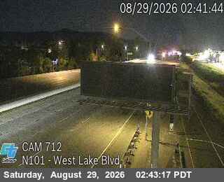 Verified · 4m
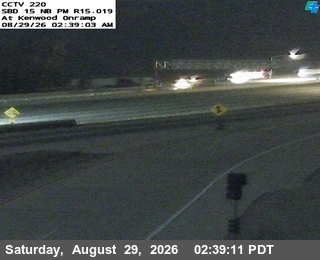 Verified · 4m
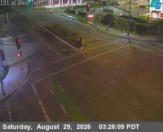 Verified · 4m
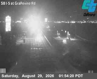 Verified · 4m
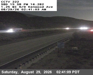 Verified · 4m
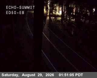 Verified · 4m
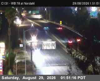 Verified · 4m
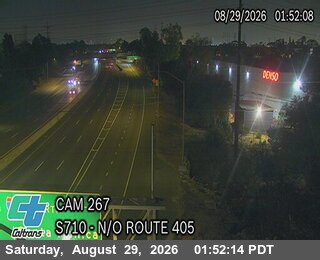 Verified · 4m
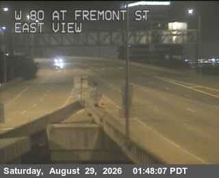 Verified · 4m
 Verified · 4m updates ~every 2 min
 Verified · 4m updates ~every 1 min
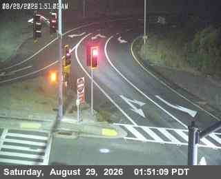 Verified · 4m updates ~every 5 min
Passes, bridges and tunnels in California
- Coronado Bridge cameras
- Cajon Pass cameras
- San Francisco Bay Bridge cameras
- San Mateo Bridge cameras
- Donner Pass cameras
- Dumbarton Bridge cameras
- Richmond-San Rafael Bridge cameras
- Vincent Thomas Bridge cameras
- Carquinez Bridge cameras
- Golden Gate Bridge Approach cameras
- Benicia-Martinez Bridge cameras
- The Grapevine (Tejon Pass) cameras
- Big Bear cameras
- Caldecott Tunnel cameras
- Lake Tahoe cameras
- Yosemite cameras
- Mount Shasta and the Siskiyous cameras
- Echo Summit cameras
- Mammoth Lakes cameras
- Santa Cruz and Highway 17 cameras
California cities
- Los Angeles traffic cameras
- San Diego traffic cameras
- Sacramento traffic cameras
- San Francisco traffic cameras
- Fresno traffic cameras
- San Jose traffic cameras
- Alameda traffic cameras
- Alhambra traffic cameras
- Aliso Viejo traffic cameras
- Anaheim traffic cameras