Tehachapi Summit Cameras, Weather & Closures - 1 Live View in California
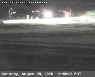
Caltrans cameras on SR-58 at Tehachapi Summit between Bakersfield and Mojave. 1 of 1 camera showed a live picture in the last 24 hours.
No lane closures currently reported by Caltrans for this area. Reports refresh about every 10 minutes.
Weather · Overnight34°F · Mostly ClearWind 10 mph W
Summit elevation4,064 ft1,239 m
Cameras1 liveof 1 tracked
Mostly clear. Low around 34, with temperatures rising to around 36 overnight. Wind chill values as low as 29. West wind around 10 mph, with gusts as high as 20 mph. Full NWS forecast · Source: National Weather Service
 Verified · 4h updates ~every 5 min
 Run Home Assistant? The Live Traffic Cam integration puts these Tehachapi Summit cameras on your dashboard, each with a verified-live sensor, plus reported disruptions for this place. No API key.
Tehachapi Summit weather & road conditions
- How do I check Tehachapi Summit road conditions?
- Check Tehachapi Summit road conditions with the live cameras on this page: 1 of 1 live in the last 24 hours. Each camera shows the pavement, weather, and traffic at its spot right now. It is a current image, not a text report or incident feed.
- Are these cameras live?
- We recheck every camera around the clock. A camera's badge shows when its feed last answered a check, and a feed that stops answering is marked offline. 1 of 1 showed a live picture in the last 24 hours.
- Is Tehachapi Summit closed right now?
- A camera is the fastest visual check, but closure calls are official ones: for closures, accident reports, and chain controls, see Caltrans road conditions. Caltrans road conditions
- What is the weather at Tehachapi Summit?
- The cameras double as Tehachapi Summit weather cams: each frame shows the sky and the road surface at its elevation right now. For a forecast, check the National Weather Service. NWS point forecast
More in California
- San Francisco Bay Bridge cameras
- Donner Pass cameras
- Golden Gate Bridge Approach cameras
- Cajon Pass cameras
- Caldecott Tunnel cameras
- Coronado Bridge cameras
- Richmond-San Rafael Bridge cameras
- San Mateo Bridge cameras
- The Grapevine (Tejon Pass) cameras